2

I have two datasets - a large polygon that contains all wards boundaries, and a gps coordinates of places visited, that fall within a city's boundaries as well as slightly outside. I'd like to save a subset of the ward polygon in such a way that not only all my gps coordinates would fall into this polygon, but that the polygon is "square/rectangular" shape.

Essentially, I would like to do the following: a) Zoom to layer the gps coordinates, to identify the area I would like to save, and b) Save the large polygon but only what is "visible" on the screen (see below)

Splitting features wouldn't work as I would have to zoom out to draw the line without actually knowing whether I would split the feature too "low" or too "high" without multiple trial and error.

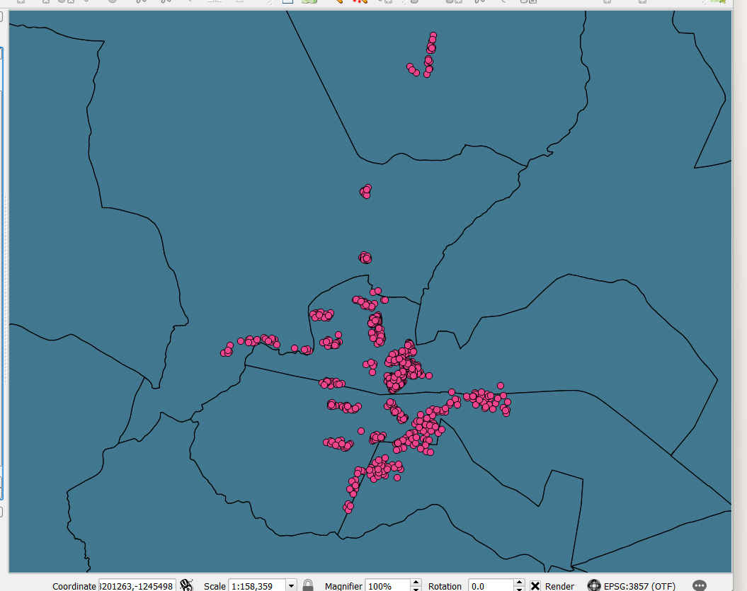
enter image description here

3
  • What tool are you planning on using?
    – Ian Turton
    Commented Apr 30 at 18:37
  • Hi Ian, I'm using QGIS version 2.18.23
    – Nick
    Commented Apr 30 at 19:13
  • well I would move to the century of the fruit bat and version 3.x
    – Ian Turton
    Commented May 1 at 9:15

1 Answer 1

4

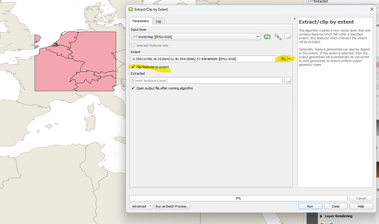
You can use the geoprocessing tool Extract/Clip by Extent. Zoom how you wish, then click the "set to current map canvas extent" button. Make sure to opt to clip the features.

enter image description here

2
  • 2
    PS: QGIS 2.18 is an archaeological artifact, I don't know if this tool existed in this era.
    – JGH
    Commented Apr 30 at 19:32
  • Thanks JGH - I'm currently downloading an updated version, I also noticed that the tool doesn't exist in the version I have.
    – Nick
    Commented Apr 30 at 20:18

Your Answer

By clicking “Post Your Answer”, you agree to our terms of service and acknowledge you have read our privacy policy.

Not the answer you're looking for? Browse other questions tagged or ask your own question.