2

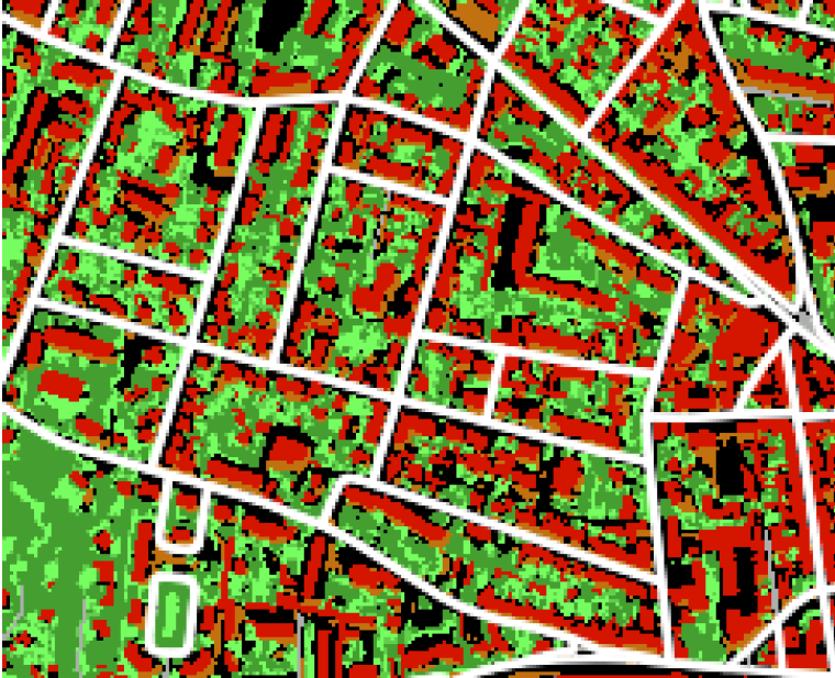
I have a shapefile with individual building footprints, each associated with a Point_ID, which represents a 250 m buffer containing multiple buildings. My goal is to merge these footprints within each buffer to create larger contiguous polygons representing entire blocks, similar to the image below "Built blocks: delineated in white and overlaid on LULC map".

enter image description here

I found similar work here: following to which I tried to:

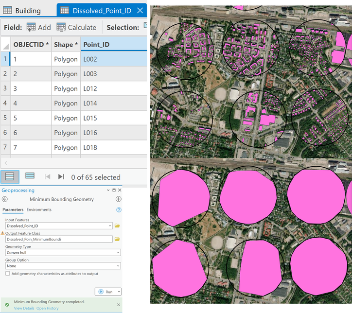
  1. Dissolve by Point_ID and then run Minimum Bounding Geometry (using Group by list--Group filed = Point_ID or Group as None)— both gave more or less extent across the buffer. Here you can see the input and output

enter image description here

  1. Without dissolving, used Group by List with Point_ID — but this resulted in the creation of a somewhat larger polygons but it seemed as buffer and not closer to the desired ones. Here you can see the input and output enter image description here
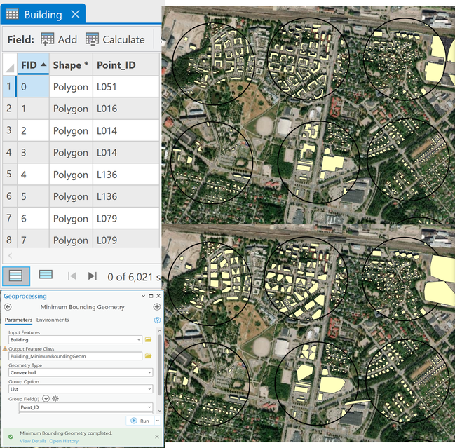
How can I effectively create clean, contiguous block polygons from these grouped buildings in ArcGIS Pro?

7
  • 1
    Your problem descriptions of "chaotic output" and "didn't help" are insufficient. This should be the focus of the Question, not the time to go vague.
    – Vince
    Commented Aug 9 at 13:02
  • Sorry for this, I have edited now. Hope this helps. Commented Aug 9 at 13:37
  • 1
    Not really. You have a picture of what you want, but not a picture of your starting place, or what you have received.
    – Vince
    Commented Aug 9 at 14:01
  • In order to have an automated solution, you need to to be able to tell the computer how to make decisions on where to place lines. So you'll need that as well.
    – Vince
    Commented Aug 9 at 22:32
  • 2
    You need more data (major road centerlines, and probably all road centerlines), then you need to invent an algorithm. You should look at the Thiessen algorithm and research partitioning theory. What you have now could be the basis for starting to "grow" influence to fill the road lattice, but this is way more effort than is appropriate for a GIS SE question.
    – Vince
    Commented Aug 10 at 13:58

0

Your Answer

By clicking “Post Your Answer”, you agree to our terms of service and acknowledge you have read our privacy policy.