I'm unsure if this what I'm looking to do is possible...
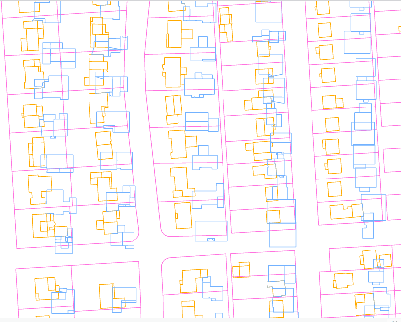
I have two polygon layers - the orange layer is georeferenced and blue is not. The pink is just a boundary layer (can be ignored). The orange and blue layers are very similar but it would require manually georeferencing to for the blue to be in the same position as orange (moving, rotating, scaling).
What I'm trying to figure out is - it is possible to automatically georeference one polygon layer using another polygon layer? Both layers do share a field with a common ID that would match.
Using ArcGIS Pro 3.2

