I have a system that allows users to input data in various geometries, with which I do some processing using JTS and then store it in a MySQL database.
A few particular polygons that my users have submitted are registering as invalid by both MySQL and JTS. I have tried to open this polygon in various viewers and they display it without issue. I also glanced over the data myself and couldn't see anything wrong.
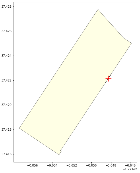
I am familiar with how a polygon can be invalid in general. What I can't figure out is what is invalid about my particular polygon. Any idea? Here is one of them:
POLYGON((-122.148755985 37.42723718100007,-122.148462038 37.42697222300006,-122.1476020649999 37.42622237100005,-122.14681093 37.42551726300007,-122.146799162 37.42550704500007,-122.1467579119999 37.42547357700005,-122.146714522 37.42544187700003,-122.146669111 37.42541203100006,-122.1466218039999 37.42538412200003,-122.146554117 37.42534915200002,-122.145898905 37.42500666200004,-122.146606488 37.42414940300006,-122.14718414 37.42346177100006,-122.147744212 37.42278424400007,-122.147784198 37.42273583200006,-122.1480067479999 37.42246395100005,-122.148371184 37.42202471400003,-122.148569196 37.42178912700007,-122.14798232 37.42249379400005,-122.1480067479999 37.42246395100005,-122.14949105 37.42068471600004,-122.149804428 37.42030734400004,-122.150144279 37.41989809300003,-122.150733848 37.41919052400004,-122.151078419 37.41877586800007,-122.151717718 37.41800663700008,-122.151912941 37.41777175300007,-122.152503005 37.41706315200003,-122.1531540729999 37.41628313600006,-122.153061958 37.41623509800007,-122.153290778 37.41595996300003,-122.153292466 37.41596085600003,-122.153309575 37.41594035100007,-122.157366324 37.41810165800007,-122.1496241789999 37.42741009900004,-122.149316868 37.42775509600006,-122.149258069 37.42770423800005,-122.149162514 37.42761216700006,-122.148755985 37.42723718100007))


