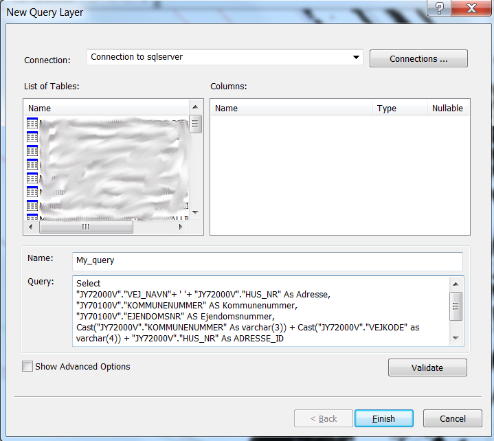
In Denmark many municipalities have the same provider of public data. These data are pushed to a local database – often a SQL Server. The DBMS layout is the same for all municipalities.
When I create a linked table from the SQL Server, I can save (or load) a .sql file in the MapInfo dialog.
This .sql-file is portable and I can share it with municipalities with the same setup – but only with MapInfo-municipalities.
Recently I had a post at a conference on this item and I urged my colleagues to use my .sql-files and/or my source code. I was however unable to guide my colleagues from the ArcGis-municipalities.
Can anyone give me some heads up on this matter? Is it possible to do In ArcGis? The .sql file from MapInfo contains the plain SQL query which is sent to the SQL Server:
I.e. :
Select
"JY72000V"."VEJ_NAVN"+ ' '+ "JY72000V"."HUS_NR" As Adresse,
"JY70100V"."KOMMUNENUMMER" AS Kommunenummer,
"JY70100V"."EJENDOMSNR" AS Ejendomsnummer,
Cast("JY72000V"."KOMMUNENUMMER" As varchar(3)) + Cast("JY72000V"."VEJKODE" as varchar(4)) + "JY72000V"."HUS_NR" As ADRESSE_ID
From "ql5020pd"."dbo"."JY70100V", "ql5020pd"."dbo"."JY72000V"
Where "JY70100V"."ADG_ID"="JY72000V"."ADG_ID"
Thanks for any help
Søren Breddam,
Stevns Kommune

