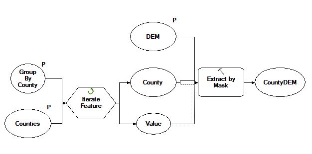
You could write a script to loop through your polygons and clip the raster to that. But the following might be quicker.
Hawth's tools has been replaced by the Geospatial Modelling Environment (GME). You will need to have the R program installed in order to run the GME. Also, GME doesn't seem to work yet in ArcGIS 10.2.
The tool you want is the Clip Raster by Polygons tool.
The description of the tool is:
This tool clips an input raster using the polygons in a polygon data
source. The command cycles through each polygon, clips the raster if
there is overlap, and writes one new raster image per polygon. The
extent of the new raster is the intersection of the extent of the
polygon and the extent of the raster.
This tool is designed to work with these three raster formats: grids,
TIFF/GeoTIFF, and ERDAS Imagine rasters. Note that not all raster
formats support all datatypes. When you are clipping a raster it is
recommended you consider two strategies to avoid these pixel data type
problems: 1) ensure the output format matches the input format, or 2)
always use the Imagine img format as the output format as this
supports all the data types. The output format is specified by adding
the appropriate file extension to the file name. No extension is
interpreted as the grid format, the '.tif' extension is the GeoTIFF
format, and the '.img' extension is the Imagine format.
Note that all clips will preserve the cell alignment of the input
raster (no shifting of pixels will occur at all). However, the display
properties of the input raster are not transferred to the output
raster, so if you are clipping digital photos or satellite images you
should expect the appearance of the clipped images to differ from that
of the original image.

