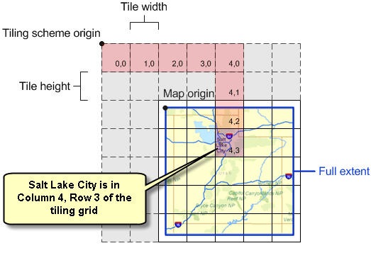
I have an ESRI TiledMapService layer and I have attached an event handler to the TileLoaded. Given the level, row, and column, how can I get the envelop of the tile in map coordinates? I'm using the ESRI Silverlight API...
What I am trying to do: I have a polygon (in the same coordinates of the TiledMapServiceLayer) and I want to examine each tile as it comes in and cut out the pixels of the tile that intersect with the polygon.
Any help would be great!

