0

I have a Uniform Grid of 1KMx1KM squares as a shapefile with population data in each grid in a specific column as an integer. I would like to extrude each polygon based on the population and export the whole dataset using a python library. ArcScene can do this, but ArcPy can't hook into that program.

Can someone recommend a python package to do this?

It doesn't have to be dependent on ArcGIS Desktop.

I was looking at matplotlib, but I can't figure out how to create 3D bar graphs.

1

1 Answer 1

1

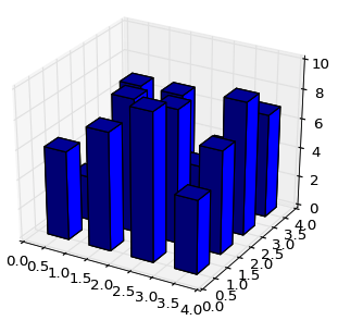
It is only necessary to learn matplotlib using the examples provided.

enter image description here

or on StackOverFlow:

You only must adapt the script to your grid (look at Visualize shapefile in Python)

As Kelsey says, you can also use Mayavi or visvis

Your Answer

By clicking “Post Your Answer”, you agree to our terms of service and acknowledge you have read our privacy policy.

Not the answer you're looking for? Browse other questions tagged or ask your own question.