I have a shapefile which comes with a wrong CRS and I would like to redefine the projection, so WITHOUT applying some transformation on the coordinates. In ArcMap you can do this with the 'Define Projection'-Tool.Is there a some tool in QGIS, which redefines the projection? I only find the reprojection function.
3 Answers
There is two tool for that (the first one create a copy of your layer, the second one create (or overwrite an already existing) projection):
- Assign projection
This algorithm assigns a new projection to a vector layer.
It creates a new layer with the exact same features and geometries as the input one, but assigned to a new CRS. E.g. the geometries are not reprojected, they are just assigned to a different CRS. This algorithm can be used to repair layers which have been
assigned an incorrect projection. Attributes are not modified by this algorithm.
- Define Shapefile projection
This algorithm sets an existing Shapefile's projection to the provided CRS. Contrary to the "Assign projection" algorithm, it will not output a new layer. The .prj and .qpj files associated with the Shapefile will be overwritten - or created if missing - to match the provided CRS.
Simply right-click the layer in the Layers panel > Layer CRS > Set Layer CRS... - no new layer will be created, simply a new CRS definition is assigned to the layer in QGIS (the data itself remains unchanged).
The do this for several layers at once, select the, then click Ctrl+Shift+C
Remark: Be careful never to use this when you want in fact to reproject a layer, as this is a very common trap that all too many users fall into.
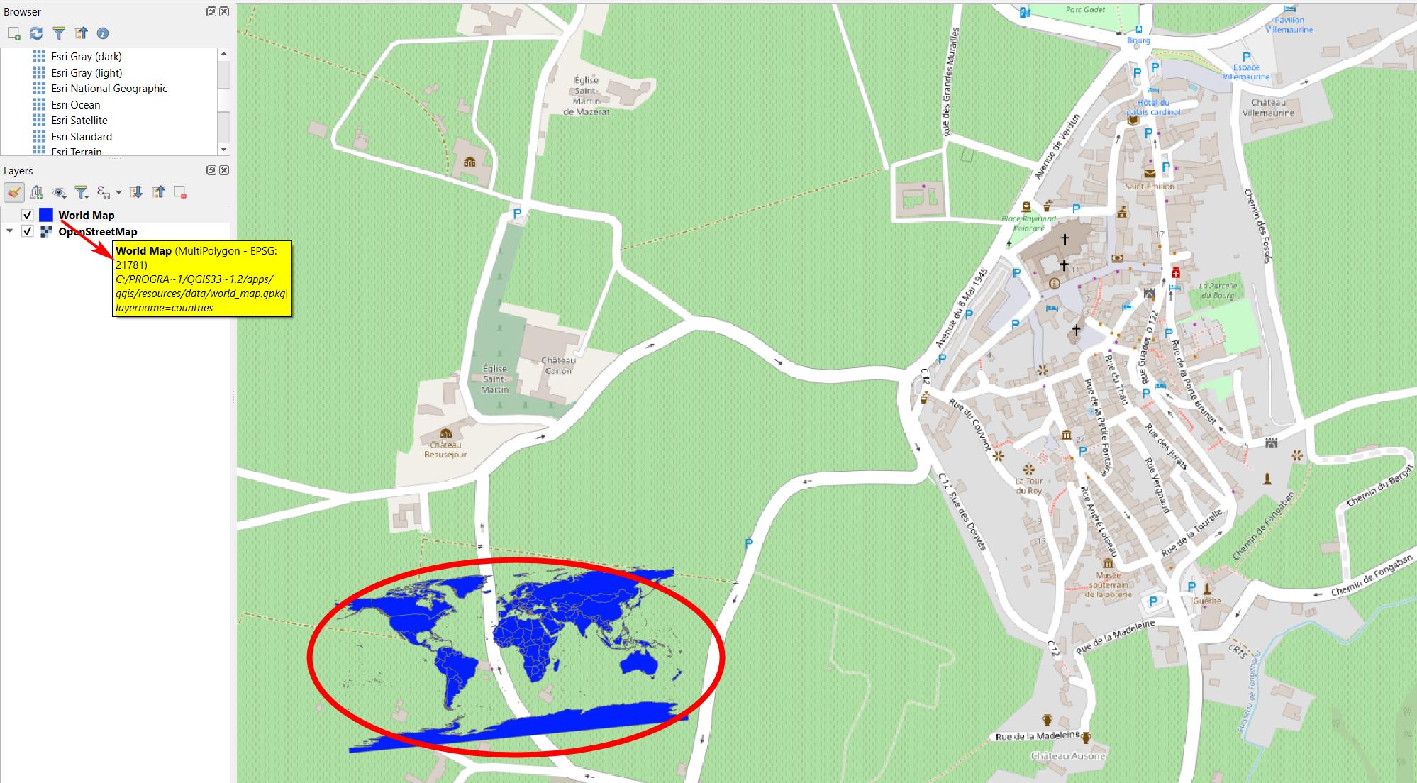
If you assign a wrong CRS, the layer will be misplaced and the features appear somewhere else on the Earth. So only use this if you are sure which CRS to assign as a layer with wrong CRS definition is of no use.
A shapefile with the countries of the world, created in EPSG:4326, with a (wrong) CRS definition EPSG:21781 suddenly appears in southwestern France, near Bordeaux:

I did find the function for my purpose: In QGIS there is the function 'Assign projection' which is described as :
"This algorithm assigns a new projection to a vector layer.
It creates a new layer with the exact same features and geometries as the input one,
but assigned to a new CRS. E.g. the geometries are not reprojected,
they are just assigned to a different CRS.
This algorithm can be used to repair layers which have been assigned an incorrect projection.
Attributes are not modified by this algorithm."
