I am currently looking for a solution where i need to find if a lat long is on the route or not. I cannot use Google Maps Geometry IsLocationOnEdge() or ContainsLocation() api's as i am working on a server side application.
The approach i am using is to find the perpendicular distance between the point and the line segment and then find the intersection point and check the distance if its within the acceptable limit.
The issue is at getting intersection point on the line segment.
I also tried the answer mentioned here. But still it doesn't work correctly. Here is the Sample data which i am testing.
- Line Points ([60.3757749,11.2075521],[60.3755244,11.2074115])
- Point to check (60.3757,11.2077)
I am using the below code snippet to find the intersection point on the line(perpendicular distance)
def get_perp( X1, Y1, X2, Y2, X3, Y3):
"""************************************************************************************************
Purpose - X1,Y1,X2,Y2 = Two points representing the ends of the line segment
          X3,Y3 = The offset point
'Returns - X4,Y4 = Returns the Point on the line perpendicular to the offset or None if no such
                    point exists
'************************************************************************************************ """
XX = X2 - X1
YY = Y2 - Y1
ShortestLength = ((XX * (X3 - X1)) + (YY * (Y3 - Y1))) / ((XX * XX) + (YY * YY))
X4 = X1 + XX * ShortestLength
Y4 = Y1 + YY * ShortestLength
if X4 < X2 and X4 > X1 and Y4 < Y2 and Y4 > Y1:
    return X4,Y4
return None
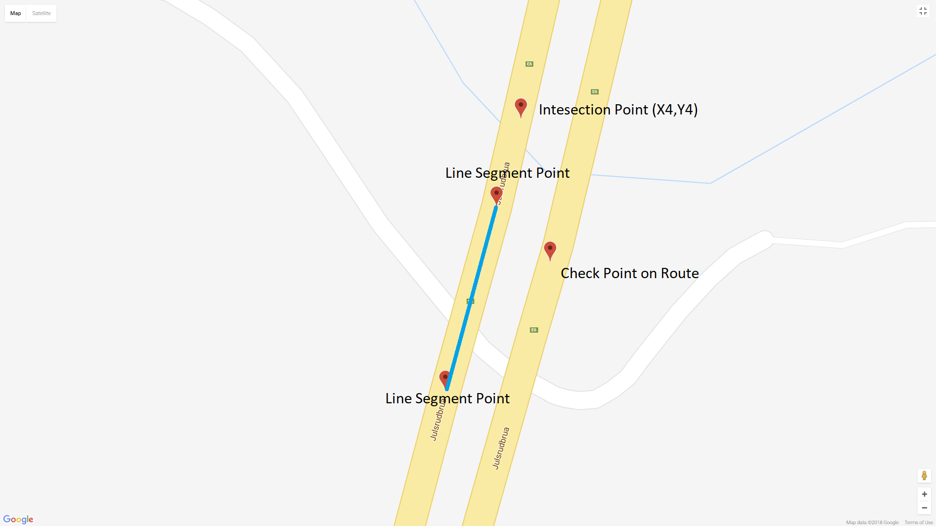
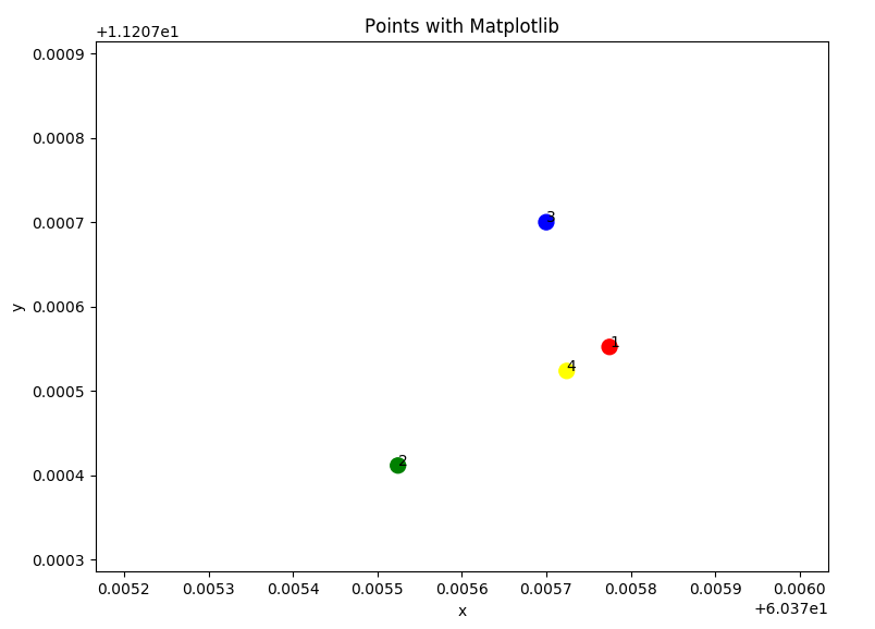
The value of X4,Y4 i am getting is (60.3758949829255,11.2076194998376), which is not on the line segment.
In the image you can see that (X4,Y4) Is never gonna be perpendicular to it.
So question is what's wrong in the Pseudo code and how to make it correct.
[Updated] as per Kogexo New Projection
import math
def get_perp( X1, Y1, X2, Y2, X3, Y3):
XX = X2 - X1
YY = Y2 - Y1
ShortestLength = ((XX * (X3 - X1)) + (YY * (Y3 - Y1))) / ((XX * XX) + (YY * YY))
X4 = X1 + XX * ShortestLength
Y4 = Y1 + YY * ShortestLength
return X4,Y4
def compute_distance(lat1, lon1, lat2, lon2):
R = 6378.137 # Radius of earth in KM
dLat = lat2 * math.pi / 180 - lat1 * math.pi / 180
dLon = lon2 * math.pi / 180 - lon1 * math.pi / 180
a = math.sin(dLat/2) * math.sin(dLat/2) + math.cos(lat1 * math.pi / 180) * math.cos(lat2 * math.pi / 180) * math.sin(dLon/2) * math.sin(dLon/2)
c = 2 * math.atan2(math.sqrt(a), math.sqrt(1-a))
d = R * c
return d * 1000 # meters

def compute_distance_radians(lat1, lon1, lat2, lon2):
# R = 6378.137 # Radius of earth in KM
dLat = lat2  - lat1
dLon = lon2 - lon1
a = math.sin(dLat/2) * math.sin(dLat/2) + math.cos(lat1) * math.cos(lat2 ) * math.sin(dLon/2) * math.sin(dLon/2)
c = 2 * math.atan2(math.sqrt(a), math.sqrt(1-a))
# d = R * c
# return d * 1000 # meters
return c

def compute_bearing(lat1, lon1, lat2, lon2):
lat1 = lat1*math.pi/180.0
lat2 = lat2*math.pi/180.0
lon1 = lon1*math.pi/180.0
lon2 = lon2*math.pi/180.0
y = math.sin(lon2-lon1) * math.cos(lat2)
x = math.cos(lat1)*math.sin(lat2) - math.sin(lat1)*math.cos(lat2)*math.cos(lon2-lon1)
brng = math.atan2(y, x)
return brng
X1=60.3757749
Y1=11.2075521
X2=60.3755244
Y2=11.2074115
X3=60.3757
Y3=11.2077
distance = compute_distance(X1, Y1, X2, Y2)
print("distance: "+str(distance))
bearing = compute_bearing(X1, Y1, X2, Y2)
print("bearing: "+str(bearing))
distance3 = compute_distance(X1, Y1, X3, Y3)
print("distance3: "+str(distance3))
bearing3 = compute_bearing(X1, Y1, X3, Y3)
print("bearing3: "+str(bearing3))
Y2p = distance * -1.0 * math.sin(bearing)
X2p = distance * math.cos(bearing)
X3p = distance3 * math.cos(bearing3)
Y3p = distance3 * -1.0 * math.sin(bearing3)
X4,Y4=get_perp( 0, 0, X2p, Y2p, X3p, Y3p)
print('X4,Y4: '+str(X4)+','+str(Y4))
distance4=compute_distance_radians(X2p, Y2p, X4, Y4)
bearing4 = bearing
R = 6378137
X4 = math.asin( math.sin(X1*math.pi/180)*math.cos(distance4/R) +                    math.cos(X1*math.pi/180)*math.sin(distance4/R)*math.cos(bearing4) )
Y4 = Y1 + math.atan2(math.sin(bearing4)*math.sin(distance4/R)*math.cos(X1*math.pi/180),
                     math.cos(distance4/R)-    math.sin(X1*math.pi/180)*math.sin(X4))*180.0/math.pi
X4 = X4*180.0/math.pi
print('X1,Y1: '+str(X1)+','+str(Y1))
print('X2,Y2: '+str(X4)+','+str(Y2))
print('X3,Y3: '+str(X4)+','+str(Y3))
print('X2p,Y2p: '+str(X2p)+','+str(Y2p))
print('X3p,Y3p: '+str(X3p)+','+str(Y3p))
print('X4,Y4: '+str(X4)+','+str(Y4))
Here are the values
 distance: 28.93889806426741
 bearing: -2.870952948395761
 distance3: 11.651304235535246
 bearing3: 2.368297140336325
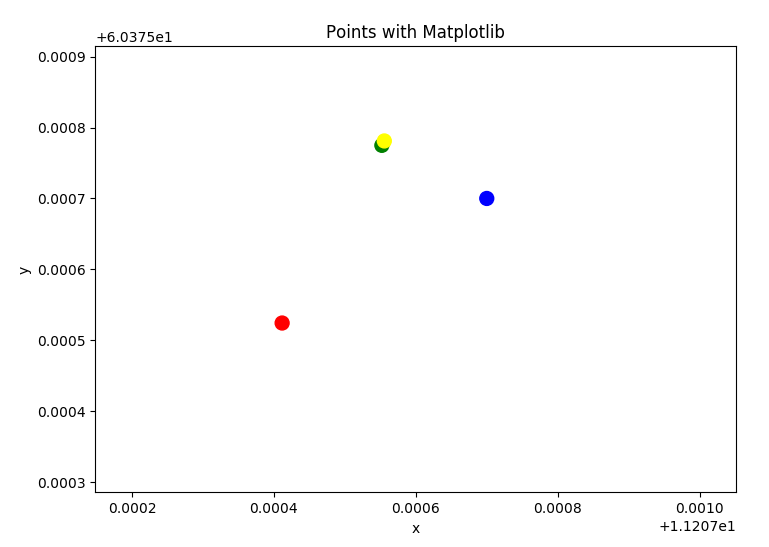
 X4,Y4: -5.6452886445122985,1.5662681805137304
 X1,Y1: 60.3757749,11.2075521
 X2,Y2: 60.375750021792385,11.2074115
 X3,Y3: 60.375750021792385,11.2077
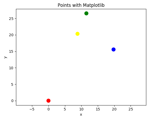
 X2p,Y2p: -27.885524191583833,7.7367539533484475
 X3p,Y3p: -8.337820728617235,-8.138404996462288
 X4,Y4: 60.375750021792385,11.20753813632277
It never clears the Condition if X4 < X2 and X4 > X1 and Y4 < Y2 and Y4 > Y1: X1 and Y1 is passed 0,0 in the snippet above


