EDIT:
My earlier answer (following this edit) describes the use of the PointsToPaths tool, which has inexplicably been removed from the Plugins repository, after having been updated to 3.x (https://github.com/chiatt/pointstopaths). More's the pity.
Fortunately, however, there is a functionally equivalent alternative:
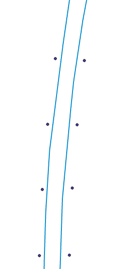
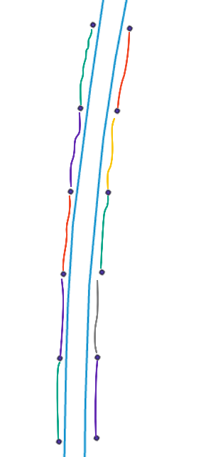
How to to create lines from points where the point attributes are transferred to the line segments?
Finally, if a user absolutely required the PointsToPaths tool, they could download a separate install of the last version of QGIS 2.x (2.18.28), and then install the 2.x version of the PointsToPaths plugin.
End of edit......
Your question is somewhat confusing, because you share nothing of your attribute data (in particular your ID and Road_ID fields), and as Bera has requested, it would be very helpful to see a little of that.
However, if your data meets three simple requirements, there is a wonderful QGIS plugin that should provide a solution. The plugin is named PointsToPaths. Note the plural Paths; this plugin has additional functionality not available in the stock Points to Path tool.
The first requirement is that the two sets of points (I'll call them "left" and "right" are found in the same layer.
The second requirement is that "left" and "right" can be distinguished from each other. I'm assuming that is the purpose of the Road_ID field, wherein all of the "left" points contain a value, such as 1, an all of the "right" points contain a different value, such as 2.
The third requirement is that the "left" and "right" points are each separately ordered sequentially (that is, from top to bottom, or vice versa), like children's "connect the dots" books. The values may skip, but they must at least ascend in a connected order. Let's call this field sequence.
In the plugin, the "Point group field" dropdown would be the Road_ID field. The "Point order field" dropdown would be the sequence field. You must check the Line to Vertex box.
Voila! The output will be a line shapefile with two new lines. Look closely at its output attribute table, and you'll see that it has three fields: group, begin, and end. The group field contains the input point's Road_ID value, which allows you to distinguish between the two new lines (aka "left" and "right"). The begin and end fields contain the two sequence values that comprise each output line segment. Using your screenshot as an example, there will be 5 output records, one for each new line segment.


