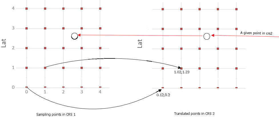
There are two Coordinate Reference System, say they are wgs84 and crs2(a local crs).
A certain location can be translated from wgs84 to crs2 by official algorithm, and the algorithm is irreversible(Because the algorithm is confidential).
Now we have a lot of locations in crs2, and we want to translate them to wgs84.
We tried to use the grid to make this.
For example, we can generate millions of points in wgs84 which have a certain distance with each other, then they will make up a gird.
Then we translate these points to crs2 one by one by the algorithm. After that, for a given point in crs2, we first find the gird it reside in , and then calculate a approximate location in wgs84.
Like this:

And the precise depend on the distance of the gird, the small the better.
I am just not sure if there is any models or best practices out of box for building the grid and make the reverse calculation as fast as possible?
