2

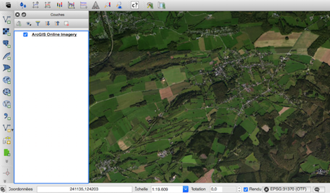
I'm trying to add this particular imagery in QGIS:

http://services.arcgisonline.com/arcgis/rest/services/World_Imagery/MapServer/3

But when i write the phyton srcipt i get the message that the URL is incorrect.

I'm getting this typical message: "Cannot open GDAL dataset http://server.arcgisonline.com/ArcGIS/rest/serââvices/World_Imagery/MapServer?f=json&pretty=true: Failed to create temporary file:/tmp/file.dat"

Anyone know what is the correct URL for High Resolution 30cm Imagery?

4

1 Answer 1

1

I use the QuickMapServices or the TileLayerPlugin plugins (see OpenStreetMap heavily pixellated when loaded in QGIS and standalone application). They automatically set the scale to the fixed resolutions of the zoom levels.

For the TileLayerPlugin, the URI is

#title  credit  serviceUrl  yOriginTop  zmin    zmax    xmin    ymin    xmax    ymax
ArcgisWorldImagery  esri    http://server.arcgisonline.com/ArcGIS/rest/services/World_Imagery/MapServer/tile/{z}/{y}/{x}.png    1   0   16  -180    -85.0   180.0   85.0

For the QuickMapServices, the URI is is referenced in the Quickmapservices contribution site (ArcGIS online imagery)

enter image description here

Your Answer

By clicking “Post Your Answer”, you agree to our terms of service and acknowledge you have read our privacy policy.

Not the answer you're looking for? Browse other questions tagged or ask your own question.