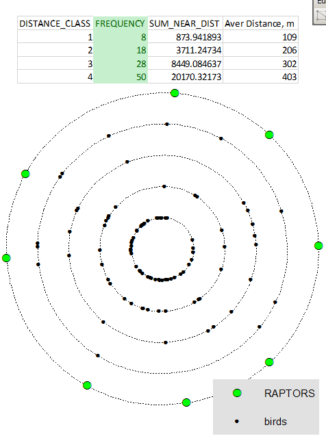
I currently have presence data on two birds, a falcon species and the grouse that it prefers to hunt. These data are in two point shapefiles, one for each species. The grouse shapefile represents all of the individuals that I've seen during observational transects, while the falcon shapefile represents all falcon nests in my study region.
I have a hypothesis that the grouse species are located in areas where they are near the fewest possible number of falcon nests (there is almost nowhere on the study site completely without falcon nests, but there are locations where nests are more concentrated). I'd like to examine this with some sort of statistical GIS analysis, but I'm not sure what steps I should take. I've been looking into kernel analysis and the near distance table.
How do I put things together into a cohesive method?
My grouse data is biased toward 3 roadways that run for miles through my study site. If possible, I'd like to also entertain method that may take this bias into account -- but only if possible!

