I tried to display long/lat (°) as points from a .csv but an
ArcMap drawing Error occurs:
One or more layers failed to draw:
2016-07-29_GPS_Collar09743_20160729125522.csv Events: An invalid SQL statement was used.
My Data look like:
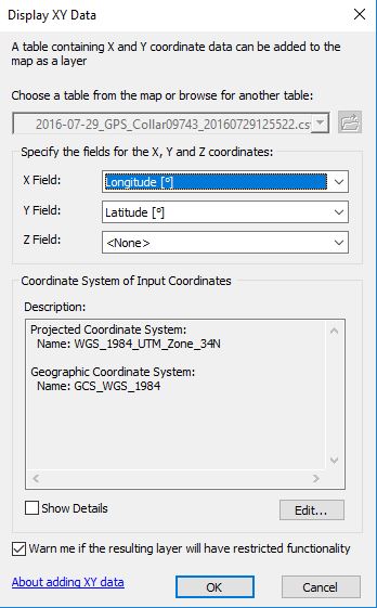
And this is the Display XY Data Window
What am I doing wrong if i want it to draw in WGS 84 ?
After the correction suggested by JGH it looks like this:
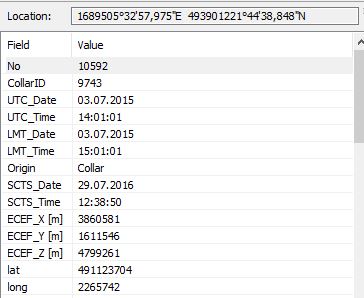
And if I use the Identify tool:


(,)to dot(.)and use Geographic CRS (WGS84). Also, I see the numbers in longitude are repeated, for example the first and second numbers in longitude are same.