I want to automatically generate a series of prints following a street for planning communcation lines next to it.
Requirements:
- fixed layout
- fixed map scale
- serial print following selected objects of a layer or a set polygon
- text-chart linked with attributes of layers.
- pages should overlap ~5%
- prefer pdf as print output
I noticed I can manually create and print a document with multiple pages and maps using the atlas function. I'd be fine with a screenshot showing the settings and how to set find these options.
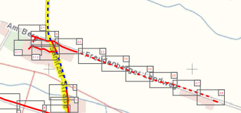
Following image shows in a Index page how it should set up the pages. The red lines will be drawn as an layer Is it possible to also get the index page printed in QGis
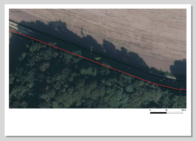
A single Page should look like this
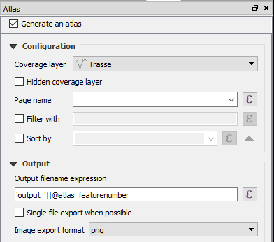
This is my current Atlas setting window but I don't see an option to let QGis generate an Atlas by itself with the coverage layer.


