2

I have a shapefile with polygons with several sizes, and I want to convert it to a raster with 30mx30m pixel resolution.

Although I was able to obtain the raster with the pretended resolution (using QGIS 3.2,Raster > Conversion > Rasterize), the file I obtained ignores a lot of several small polygons; that is, the polygons are not converted in one or more pixels.

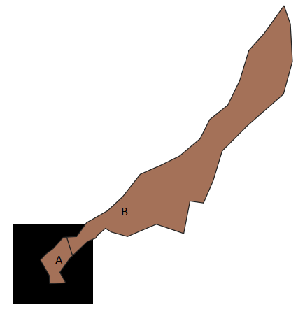
Additionally, there are small polygons converted in a pixel but other larger polygons are not converted. See this example below:

enter image description here

In this case, the pixel is 30x30m, A is ~111 and B is ~1642 square meters.

Questions:

1) Does anyone know how this conversion works, i.e., what are the criteria for converting a polygon in a raster? Using the example in the picture, why was A converted in a pixel and B was not?

2) Is there a way to calibrate/choose the size of the polygons to be considered for conversion?

2 Answers 2

2

I believe this is very much related to how the pixel is constructed. Imagine that QGIS or ArcMAP, or any other software creates a virtual grid on top of the polygons with the extent of these. Then it takes the "centroids" to create the pixels.

I did the same with small and medium polygons, of all sort of figures, and those polygons that are thin (like a sausage) do not get converted in the majority of the times.

If you increase the resolution, for instance, 10x10 you may get not only two pixels, but even more.

2

I would start by testing to see if you have errors in the polygon. Perhaps that is the problem.

Your Answer

By clicking “Post Your Answer”, you agree to our terms of service and acknowledge you have read our privacy policy.

Not the answer you're looking for? Browse other questions tagged or ask your own question.