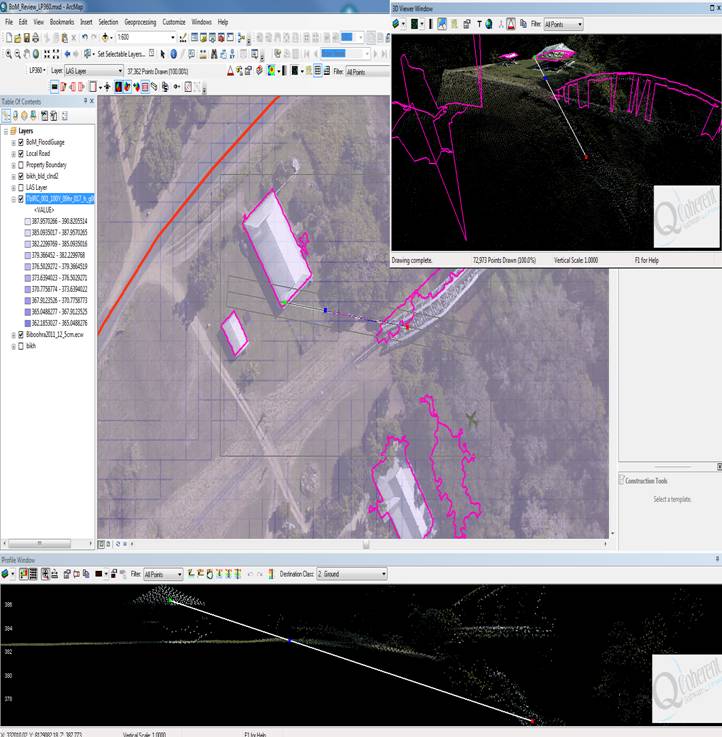
I was wondering if it is possible to generate the floor heights of buildings from aerial lidar? We don't have terrestrial lidar or stereo imagery. I don't need the ground DEM level or the roof (DSM) level but the height above the ground where the ground floor is.
The main current requirement is -A number of buildings are on stilts and built to allow for seasonal flooding so when flood models are brought in they shouldn't be classified as high risk since they are designed to allow water to flow under them. Other building are not on stilts but raised off the ground so a max flood height of 845 for example won't affect the building as it's min floor level is 845.5.
Lots of photogrammetry software using Stereo imagery/terrestrial lidar data will allow us to automate the creation of 3D building footprints (with floor height) and build 3D models for visualizing the effect of flooding (an example workflow) BUT what can we do if the only input is aerial 4ppm Lidar and 125mm orthophotos? I looked at coupling it with google streetview but many houses are not covered as they are on private roads away from public view.
See Building extraction with LiDAR data (Improve Process) and Simulate flood to assess Asset inundation footprints for background.
We have arcgis 10.1 and ERDAS Imagine/ER Mapper and I am also testing a number of lidar analysis tools like LP360, Lastools, Lidar Analyst and E3De for this.

Thanks,
