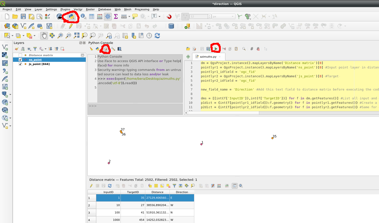
I've got a distance matrix with entities with an Input ID, target ID, and distance. I'm looking for a way to find out the relative direction of the input ID columnn to the target ID column.
-
The distance matrix was created with one point layer as input or two?– BeraCommented Sep 11, 2020 at 16:57
-
two point layers were used to make it, but I've got the matrix plotted as a point layer on QGIS (as well as the original two layers)– JamesCommented Sep 11, 2020 at 17:05
-
Is the distance matrix generated from an initial layer? And these "target ids", do they come from a different layer?– wfgeoCommented Sep 11, 2020 at 17:09
-
My distance matrix is generated from two initial layers, Layer 1 has the Input IDs and Layer 2 has the Target IDs.– JamesCommented Sep 11, 2020 at 17:22
Add a comment
|
1 Answer
This became a little bit convoluted but it seems to be working.
For each pair of points azimuth is calculated then translated into directions (N, E ,S or W)
Change layer and field names to match your data:
dm = QgsProject.instance().mapLayersByName('Distance matrix')[0]
pointlyr1 = QgsProject.instance().mapLayersByName('ns_point')[0] #Input point layer in distance matrix
pointlyr1_idfield = 'ogc_fid'
pointlyr2 = QgsProject.instance().mapLayersByName('js_point')[0] #Target
pointlyr2_idfield = 'ogc_fid'

new_field_name = 'Direction' #Add this text field to distance matrix before executing the code

dms = [[int(f['InputID']),int(f['TargetID'])] for f in dm.getFeatures()] #List all input and target ids
p1dict = {int(f[pointlyr1_idfield]):f.geometry() for f in pointlyr1.getFeatures()} #Create a dictionary of id and geometry for input
p2dict = {int(f[pointlyr2_idfield]):f.geometry() for f in pointlyr2.getFeatures()} #Same for target

directions = [] #List to hold directions (N,E,S,W)

for id1, id2 in dms:
    #For each pair of points calculate azimuth (-180 - +180)
    az = p1dict[id1].asPoint().azimuth(p2dict[id2].asPoint())
    def calcdir(a):
        #Translate azimuth to compass direction
        if -45<a<45:
            v = 'N'
        elif 45<=a<135:
            v = 'E'
        elif 135<=a<=180 or -180<=a<=-135:
            v = 'S'
        else:
            v = 'W'
        return v
    directions.append(calcdir(az))
#Write directions list to a column in Distance matrix layer
with edit(dm):
    for feat, direct in zip(dm.getFeatures(), directions):
        #print(feat.id(), direct)
        feat.setAttribute(feat.fieldNameIndex(new_field_name), direct)
        dm.updateFeature(feat)

