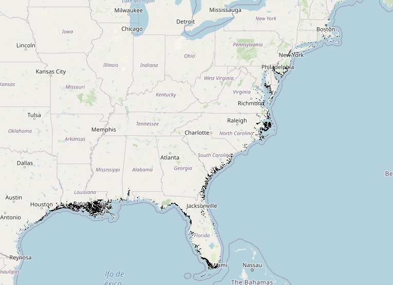
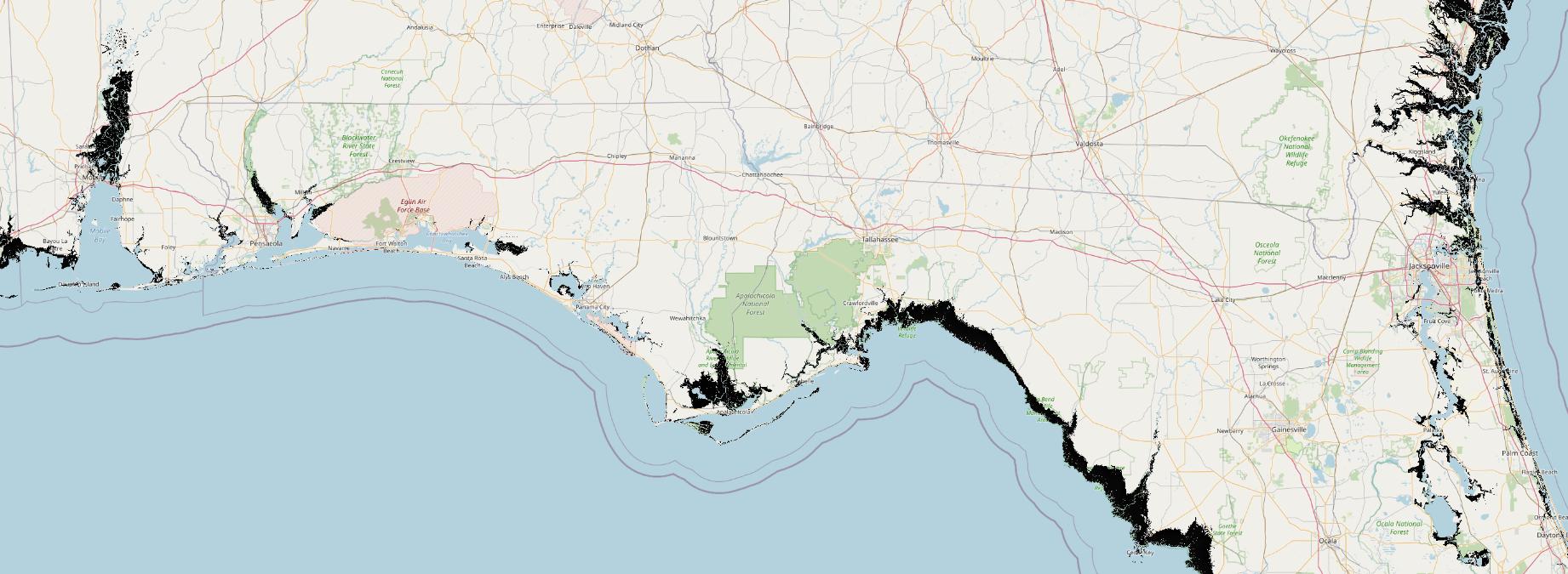
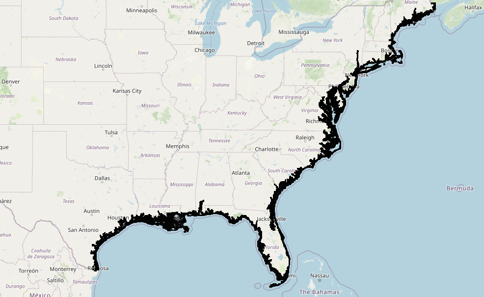
I have five GeoTIFF files that I have setup in GeoServer. I am displaying these on a OpenLayers map. I have tried some recommendations in the data considerations, such as inner tiling and setting up overviews, however the performance seems lacking being that these aren't very large files. I was hoping I could get some feedback as to a good way to structure these TIFFs to optimize performance when tiling. See below the output for file info of the unaltered files:
Driver: GTiff/GeoTIFF
Size is 109320, 88072
Coordinate System is:
PROJCS["WGS 84 / Pseudo-Mercator",
    GEOGCS["WGS 84",
        DATUM["WGS_1984",
            SPHEROID["WGS 84",6378137,298.257223563,
                AUTHORITY["EPSG","7030"]],
            AUTHORITY["EPSG","6326"]],
        PRIMEM["Greenwich",0,
            AUTHORITY["EPSG","8901"]],
        UNIT["degree",0.0174532925199433,
            AUTHORITY["EPSG","9122"]],
        AUTHORITY["EPSG","4326"]],
    PROJECTION["Mercator_1SP"],
    PARAMETER["central_meridian",0],
    PARAMETER["scale_factor",1],
    PARAMETER["false_easting",0],
    PARAMETER["false_northing",0],
    UNIT["metre",1,
        AUTHORITY["EPSG","9001"]],
    AXIS["X",EAST],
    AXIS["Y",NORTH],
    EXTENSION["PROJ4","+proj=merc +a=6378137 +b=6378137 +lat_ts=0.0 +lon_0=0.0 +x_0=0.0 +y_0=0 +k=1.0 +units=m +nadgrids=@null +wktext +no_defs"],
    AUTHORITY["EPSG","3857"]]
Origin = (-10968941.448953511193395,5653006.415421720594168)
Pixel Size = (32.241277618252468,-32.241277618252468)
Metadata:
  AREA_OR_POINT=Area
  DataType=Generic
Image Structure Metadata:
  INTERLEAVE=BAND
Corner Coordinates:
Upper Left  (-10968941.449, 5653006.415) ( 98d32' 8.44"W, 45d11'58.72"N)
Lower Left  (-10968941.449, 2813452.613) ( 98d32' 8.44"W, 24d29'30.51"N)
Upper Right (-7444324.980, 5653006.415) ( 66d52'24.63"W, 45d11'58.72"N)
Lower Right (-7444324.980, 2813452.613) ( 66d52'24.63"W, 24d29'30.51"N)
Center      (-9206633.214, 4233229.514) ( 82d42'16.54"W, 35d30'31.36"N)
Band 1 Block=109320x1 Type=Byte, ColorInterp=Gray
  NoData Value=255
  Metadata:
    RepresentationType=THEMATIC


Driver: GTiff/GeoTIFF
Size is 109320, 88072
Coordinate System is:
PROJCS["WGS 84 / Pseudo-Mercator",
    GEOGCS["WGS 84",
        DATUM["WGS_1984",
            SPHEROID["WGS 84",6378137,298.257223563,
                AUTHORITY["EPSG","7030"]],
            AUTHORITY["EPSG","6326"]],
        PRIMEM["Greenwich",0,
            AUTHORITY["EPSG","8901"]],
        UNIT["degree",0.0174532925199433,
            AUTHORITY["EPSG","9122"]],
        AUTHORITY["EPSG","4326"]],
    PROJECTION["Mercator_1SP"],
    PARAMETER["central_meridian",0],
    PARAMETER["scale_factor",1],
    PARAMETER["false_easting",0],
    PARAMETER["false_northing",0],
    UNIT["metre",1,
        AUTHORITY["EPSG","9001"]],
    AXIS["X",EAST],
    AXIS["Y",NORTH],
    EXTENSION["PROJ4","+proj=merc +a=6378137 +b=6378137 +lat_ts=0.0 +lon_0=0.0 +x_0=0.0 +y_0=0 +k=1.0 +units=m +nadgrids=@null +wktext +no_defs"],
    AUTHORITY["EPSG","3857"]]
Origin = (-10968941.448953511193395,5653006.415421720594168)
Pixel Size = (32.241277618252475,-32.241277618252475)
Metadata:
  AREA_OR_POINT=Area
  DataType=Generic
Image Structure Metadata:
  COMPRESSION=LZW
  INTERLEAVE=BAND
Corner Coordinates:
Upper Left  (-10968941.449, 5653006.415) ( 98d32' 8.44"W, 45d11'58.72"N)
Lower Left  (-10968941.449, 2813452.613) ( 98d32' 8.44"W, 24d29'30.51"N)
Upper Right (-7444324.980, 5653006.415) ( 66d52'24.63"W, 45d11'58.72"N)
Lower Right (-7444324.980, 2813452.613) ( 66d52'24.63"W, 24d29'30.51"N)
Center      (-9206633.214, 4233229.514) ( 82d42'16.54"W, 35d30'31.36"N)
Band 1 Block=256x256 Type=Byte, ColorInterp=Gray
  NoData Value=255
  Overviews: 54660x44036, 27330x22018, 13665x11009, 6833x5505, 3417x2753, 1709x1377, 855x689, 428x345, 214x173
  Metadata:
    RepresentationType=THEMATIC
gdalinfo output.tif -stats:
Driver: GTiff/GeoTIFF
Size is 109320, 88072
Coordinate System is:
PROJCS["WGS 84 / Pseudo-Mercator",
    GEOGCS["WGS 84",
        DATUM["WGS_1984",
            SPHEROID["WGS 84",6378137,298.257223563,
                AUTHORITY["EPSG","7030"]],
            AUTHORITY["EPSG","6326"]],
        PRIMEM["Greenwich",0,
            AUTHORITY["EPSG","8901"]],
        UNIT["degree",0.0174532925199433,
            AUTHORITY["EPSG","9122"]],
        AUTHORITY["EPSG","4326"]],
    PROJECTION["Mercator_1SP"],
    PARAMETER["central_meridian",0],
    PARAMETER["scale_factor",1],
    PARAMETER["false_easting",0],
    PARAMETER["false_northing",0],
    UNIT["metre",1,
        AUTHORITY["EPSG","9001"]],
    AXIS["X",EAST],
    AXIS["Y",NORTH],
    EXTENSION["PROJ4","+proj=merc +a=6378137 +b=6378137 +lat_ts=0.0 +lon_0=0.0 +x_0=0.0 +y_0=0 +k=1.0 +units=m +nadgrids=@null +wktext +no_defs"],
    AUTHORITY["EPSG","3857"]]
Origin = (-10968941.448953511193395,5653006.415421720594168)
Pixel Size = (32.241277618252475,-32.241277618252475)
Metadata:
  AREA_OR_POINT=Area
  DataType=Generic
Image Structure Metadata:
  COMPRESSION=LZW
  INTERLEAVE=BAND
Corner Coordinates:
Upper Left  (-10968941.449, 5653006.415) ( 98d32' 8.44"W, 45d11'58.72"N)
Lower Left  (-10968941.449, 2813452.613) ( 98d32' 8.44"W, 24d29'30.51"N)
Upper Right (-7444324.980, 5653006.415) ( 66d52'24.63"W, 45d11'58.72"N)
Lower Right (-7444324.980, 2813452.613) ( 66d52'24.63"W, 24d29'30.51"N)
Center      (-9206633.214, 4233229.514) ( 82d42'16.54"W, 35d30'31.36"N)
Band 1 Block=256x256 Type=Byte, ColorInterp=Gray
  Minimum=1.000, Maximum=99.000, Mean=7.573, StdDev=17.275
  NoData Value=255
  Overviews: 54660x44036, 27330x22018, 13665x11009, 6833x5505, 3417x2753, 1709x1377, 855x689, 428x345, 214x173
  Metadata:
    RepresentationType=THEMATIC
    STATISTICS_MAXIMUM=99
    STATISTICS_MEAN=7.5732497554581
    STATISTICS_MINIMUM=1
    STATISTICS_STDDEV=17.27458624911
I tried the following:
- Tiled 256x256 and 512x512 -- This slowed down performance
- Added overviews(with average and bilinear resampling) -- This sped up performance on first load of course, however it filled in null values to the point that looked misrepresentative of the data (See images)


