3

I'm working on a project which goes beyond my knowledges, I need your help.

I'm working with FLIR movies (thermal imagery recorded from plane), and I have to find a way to make a Tiff containing the temperature information and geographic information. I can extract images from the movies in different ways (png, jpeg, csv, Tiff, 32 bit tiff, FITS).

My plan was to extract one jpeg/second and then stitch those thousand of pictures with hugin, then georeference the stitched result on ArcGis.

My problem is that I suppose the JPEG will be in RGB format so the temperature won't be displayed...

So the only way might be to export 1 32 bit tiff/second (which is the only format with the real temperature information) and then try to stitch them together... But I don't see how. The study area is really huge so I have 5000 thousand pictures each day, so I can't afford any manual method.

Does someone has a genuis idea?

3
  • You got telemetry data from your UAV?
    – nickves
    Commented Nov 7, 2012 at 1:15
  • Why is 1 32 bit tiff/second the only data format that contains temperature information? What you need is a data format that does not compress the data and that keeps the 32bit precision from FLIR! Are you sure you need a TIFF every second. Adjust the time interval so that the images overlap to ~30%. Do you have the flight path information as a GPS track or something?
    – Michael
    Commented Nov 7, 2012 at 1:51
  • Thanks a lot for the answer, I have indeed a GPS track. The only choice for the extraction are png, jpeg, csv, Tiff, 32 bit tiff, FITS so the only one which does not compress the data is 32 bit TIFF. I've got some GPS track and some optical data as well nothing more. Commented Nov 7, 2012 at 18:23

1 Answer 1

2

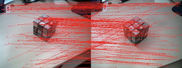
If you are grabbing images from different frames, what you want to do is to make sure they overlap somehow (depending on the speed of the aircraft, 1s may or may not be enough). Then, you need to find features from both images that match each other. There are several algorithms and libraries (like OpenCV) that help you do this.

similar features in both images enter image description here

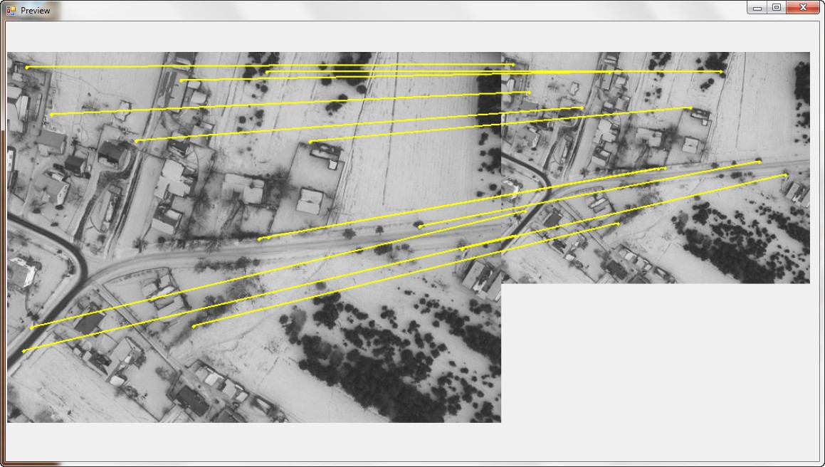
Both image above shows you the popular SURF algorithm in action. Each redline is connecting the two features (pixels) that have been identified as the same.

What you can do, is arbitrarily pick one image as the reference one (say the left one) and treat it as a Ground Control Point. What you can do then is warp the right image to fit the left one based on those GCPs.

Lucky for you, I stole the second image from the blog of one of the participants of this year's Google Summer of Code for the GDAL project.

If you look at the GitHub of that project, you will find that there is a sample program that does the first part (run Surf on two images to find the matching features).

Now you can use that resulting point list as GCPs. To do that you can create a VRT dataset and gdalwarp to warp the images. Instead of describing the process for that, I would recommend you look at several of the answers in GIS.SE that describe how to use GCPs and VRTs. Nevertheless, let me suggest you right of the bat to use the Thin Plate Spline Transformer option available in gdalwarp (the tps flag). I spent several hours one time myself trying to figure out why my warped images were not being forced to use the GCPs until I finally went to the GDAL IRC channel - which by the way is the best place to get GDAL support hands down.

8
  • Thanks! Is this solution working with some 32 bit tiff? Commented Nov 7, 2012 at 18:28
  • The solution works with anything that gdal can read. tiff/geotiff is one of the supported formats (from several other ones) Commented Nov 7, 2012 at 19:05
  • gdal.org/frmt_gtiff.html Commented Nov 7, 2012 at 19:07
  • By the way, since it sounds like temperature is in another band (R+G+B+Temperature), this would also work for datasets with several other bands, too. 5/6/80 whatever Commented Nov 7, 2012 at 19:11
  • That sounds great! I just have to figure out how to script that for my 5000 pictures :D. And I didn't get yet how to actually stitch them together but i'm working on it Commented Nov 8, 2012 at 0:16

Your Answer

By clicking “Post Your Answer”, you agree to our terms of service and acknowledge you have read our privacy policy.

Not the answer you're looking for? Browse other questions tagged or ask your own question.