0

I was working with the Google satellite basemap from QuickMapServices using the projected coordinate system NAD83(2011)/UTM zone 15N, and everything was working fine, but today after the upgrade of QGIS the basemap is not displaying as it was before.

I understand that the original CRS of this basemap is WGS84, but why was it working before and not now? Is there any solution besides reprojecting my data to WGS84 (I need a CRS working on meters, and I have more than 1000 files in .las format that I don't want to reproject)?

EDIT: When I say it is not displaying as before, I meant that it appears in the wrong place, like if the data and the basemap were on different planets. Or just doesn't appear anywhere.

EDIT 2: I am adding a screenshot that may be useful, it shows the project properties. First, when I try to select the CRS that I want for my project (EPSG:6344 - NAD83(2011)/UTM zone 15N) is like QGIS doesn't know where the projection should be used. Here is the description of this CRS, and before the upgrade, this was shown in the image below https://epsg.io/6344.

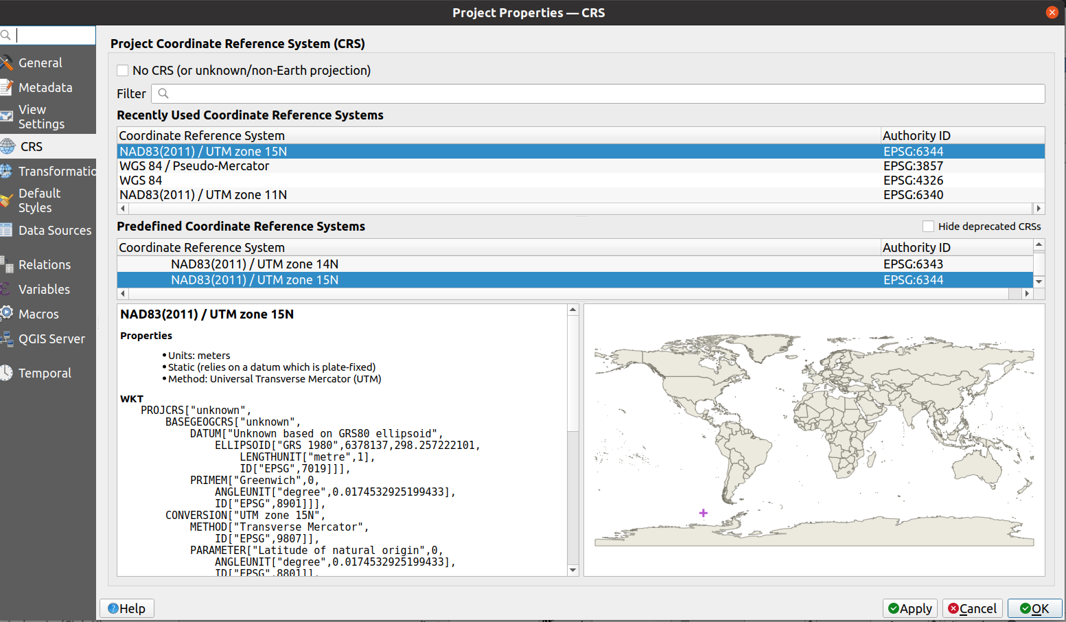
enter image description here

7
  • It would help if you shared more information - what do you mean by 'not displaying as it was before'. Is nothing showing up, or is it showing up in the wrong place, or is it distorted? If you could share a screenshot of what you're seeing that would help.
    – she_weeds
    Commented May 19, 2022 at 1:18
  • Hi @she_weeds I added the answer to your question, I did not post the screenshots because they are just whiteboards because the basemap is not displaying on the screen today.
    – Na_Na_Na
    Commented May 30, 2022 at 17:28
  • 1
    Did you just open an old project with the new version or did you add the base map in a new project ? Id you opened an old one try to reset the basemap projection ( it probably not straight wgs84 but rather web mercator)
    – J.R
    Commented May 30, 2022 at 22:24
  • Both. I used to use the basemap in an old project, and after the upgrade, the basemap disappeared from that project (it wasn't visible in my study area). Now, when I created a new project with the projected system that I need, it shows but in the wrong place compared to my data, this is what I mean by a different planet. When I hover my mouse over the data I see coordinates in NAD83(2011)/UTM zone 15N, when I do it over the basemap the coordinates are in WGS84.
    – Na_Na_Na
    Commented May 31, 2022 at 18:29
  • Did you touch the basemap's CRS at all? Don't! It should probably be EPSG:3857 and QMS does that correctly. I have no issues looking at a Google map loaded with QMS and the project CRS set to 6344 here if I zoom in onto the USA enough. Commented May 31, 2022 at 19:51

1 Answer 1

0

I just fix my problem.

  1. I uninstalled Qgis using the instructions given here Uninstall Qgis

  2. Then, I tried to install it again using the official instructions from Qgis this give me the error

    The following packages have unmet dependencies:

    qgis-plugin-grass : Depends: grass782

    E: Unable to correct problems, you have held broken packages.

  3. Therefore, I could not use the qgis-plugin-grass, this apparently controls the functions that I was trying to use (not sure how, or why). Finally, after many tries, I find this issue in the Qgis github repository, they explain in more detail why to change this line in the installation sudo add-apt-repository "deb https://qgis.org/ubuntu $(lsb_release -c -s) main" by this one sudo add-apt-repository "deb https://qgis.org/ubuntugis $(lsb_release -c -s) main"

so, in conclusion, uninstall and then install but with the ubuntugis repository.

Your Answer

By clicking “Post Your Answer”, you agree to our terms of service and acknowledge you have read our privacy policy.

Not the answer you're looking for? Browse other questions tagged or ask your own question.