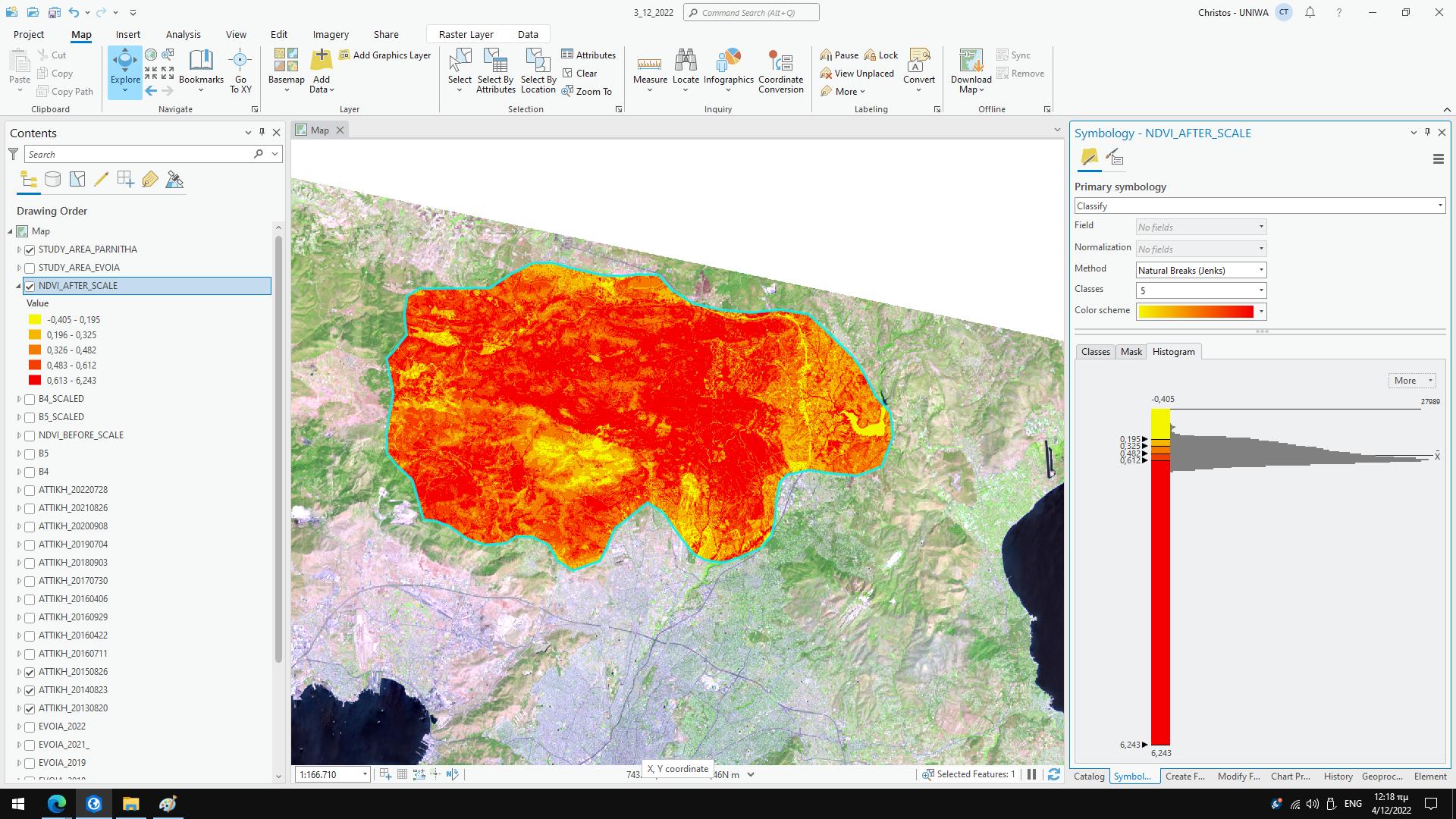
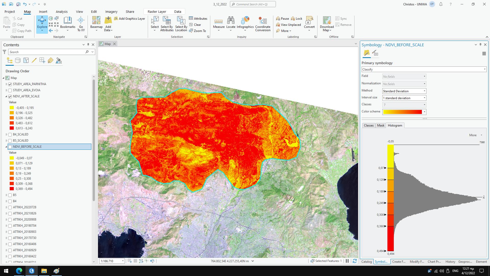
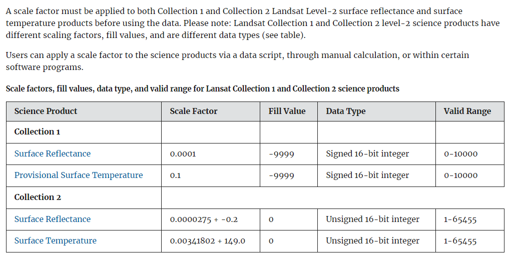
I am using Landsat 8 C2L2 and I would like to compose Bands 1-6. If I don't apply the scale factor at all, what would be the problem? Also, when I am trying to find, for instance, NDVI value after I have applied a scaling factor to bands 4, 5, my new band'5 value is shown bellow like NDVI range. On the other hand, when I calculate NDVI without using the scaling factor I get the expected results. Why is this happening?
1 Answer
Generally, we always want to scale our units to the correct units of measurement. Scaling is often for data compression purposes but it isn't well suited for scientific purposes. Surface reflectance is a scientific unit and should be treated as such. You cannot substitute them for scaled values.
However, it is possible to have NDVI values outside of your expected range of -1 to 1. This can occur where you have very noisy or anomalous pixels, so the expected relationship between RED and NIR does not hold true. You may want to look at whether the pixel values in various places in your image image look right, rather than just relying on the stretch (min and max). for example does vegetation have a value of 0.4 and above? Is water around the 0 value? Is bare ground also a low value? These are general values that we would expected to see for known land covers.
-
I think that I have no noisy or anomalous pixels as you can see in the first image which I attached (I uploaded a new one). May you please explain what do you mean by that "You cannot substitute them for scaled values". Does it mean that, I can't apply math operations on scaled values? I still, can't understand when I must apply scale factors. @GeoMonkey– ChrisCommented Dec 3, 2022 at 22:00
-
You cannot apply math operations on scaled values. You should apply the offsets and then do the math on the unscaled data. Do not use the stretch as an indicator of your pixel values. If even one pixel is anomalous, it will cause the very large stretch to occur. The distribution of the pixel values is more important than the minimum and maximum Commented Dec 3, 2022 at 22:11
-
As I understand, my first attached image which shows scaled NDVI values is wrong (because as you say, it isn't allowed to apply math operations on scaled values). I just uploaded it for example. The second attached image shows unscaled NDVI values using standard deviation as an indicator, is it a good option? Also, what is the meaning of applying the offset? What can I do with the scaled values? @GeoMonkey– ChrisCommented Dec 3, 2022 at 22:27
-
The scaled values are of no real scientific use. The values are scaled because it is easer to store and move around integer files than floating point files. The values are scaled just for data storage/movement purposes. They make the file size smaller. Looking at the unscaled NDVI, you have a good normal-ish distribution of NDVI values Commented Dec 3, 2022 at 22:38
-
1


