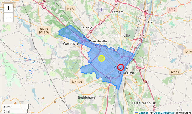
In the following image, I've plotted the administrative boundaries of Albany NY.
The yellow point is the centroid. The red point is the Geocoded location as identified by Nominatim.
Are the points identified by Nominatim hardcoded into a database or are they calculated?
If they are calculated, how are they determined?
Sidenote - my end goal is to identify the "center" of city in a more meaningful way than calculating the centroid. It looks like Nominatim is capable of doing that, but if it's just a hardcoded value that doesn't help me much. I'd like to be able to do it for arbitrary geographic regions.

