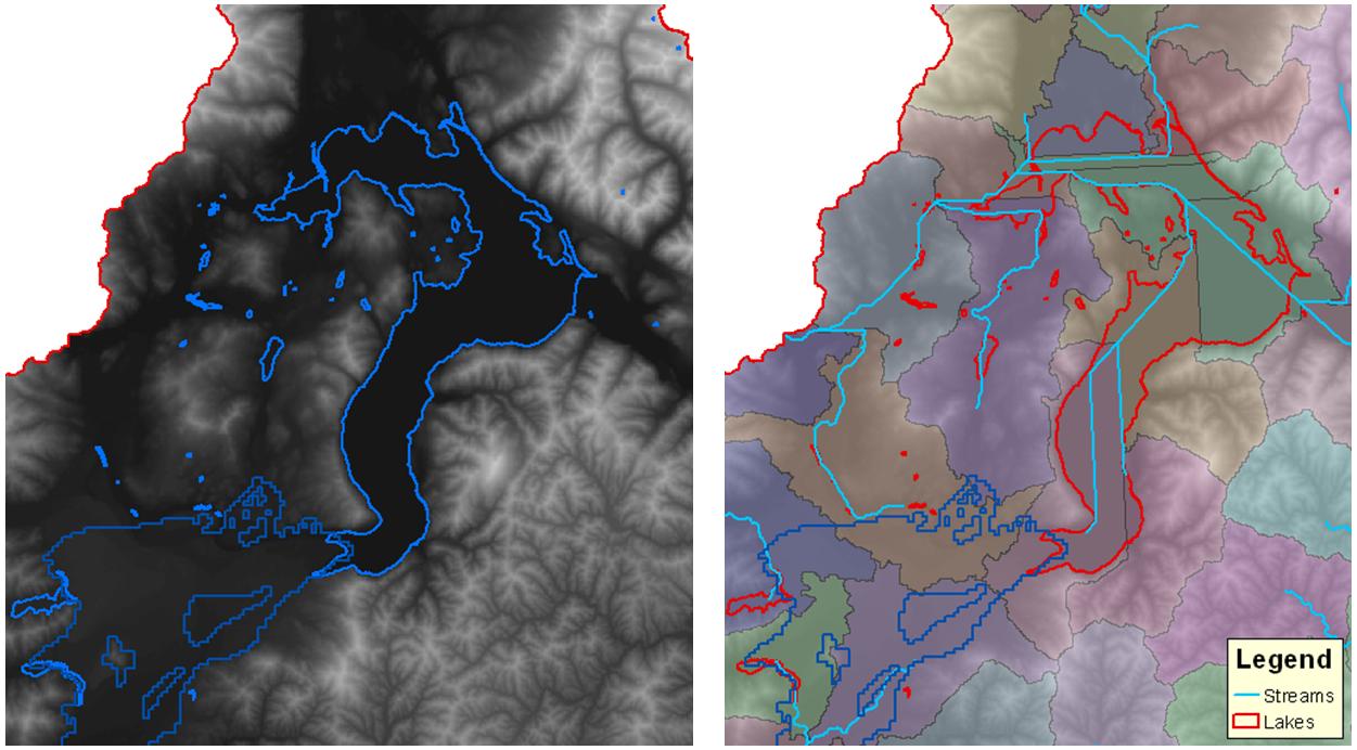
My watershed has several big lakes. When I delineated my watershed, I had some unwanted subwatersheds and river segments inside the lakes (see fig. below). I want to tell ArcGIS/ArcHydro to delineate my watershed but ignore places where there are lakes/reservoir. Moreover, the generated subwatershed and streams should be consistent in terms of cascading flow from upstream to downstream e.g. subwatershed 2 flows to the lake and water from the lake flows to subwatershed 3, etc.
Any suggestion would be highly appreciated. Thanks!

