4

I am trying to understand if the Landsat 7 satellite ETM+ orbit has any significant azimuth or if it could be assumed as 0° (as it is not a pointable sensor). I searched in the web but could not find any good answer so far. Zenith is supposed to be equal zero as Landsat images are always nadir.

What about the azimuth?

Would knowing the scene center coordinates (they're 46.036323 N and 10.456876 E) be of any help?

The image looks like a sort of isosceles trapezoid, with the major basis towards the North (as I would expect for the Northern Hemisphere). It is also tilted differently from south to North (as I also would expect).


One question arose while I was trying to solve my task. The metadata file of Landsat provides coordinates of the four image corners. Anyway they refer to the black background.

The azimuth is intended to be calculated through these corners or the corners of the "real"-non-background image?

And why do I have to use latitude rather than longitude?

Is it not better to use longitude?

I thought to use (for instance) the right corners, subctracting the longitudes of them (e.g. upper right long-lower right long) and obtain what I was looking for in terms of degrees, does it make sense for you?

Here is an image showing a part of Landsat paths in a Worldwide Reference System (descending orbit) and my Landsat scene. RS is geographic, WGS84. According to this what I should looking at is the non-background image.
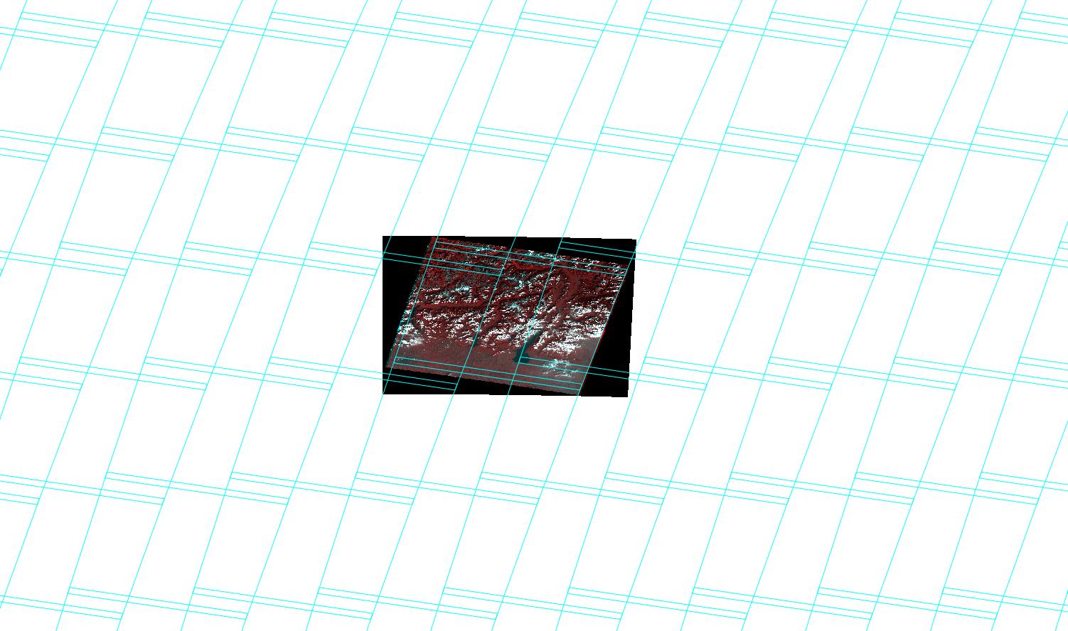
Landsat in the WRS path

3
  • Why do you wish to know the satellite azimuth? Are you trying to do an accurate geo-rectification of the scene? If so, you should probably research that, or geometric correction, and possibly ask a separate, new question. There are many issues involved: one of them being that Landsat scenes are (or used to be, many years ago) available in un-rectified and rectified forms.
    – Martin F
    Commented Apr 10, 2014 at 15:52
  • Also see gis.stackexchange.com/questions/91062/…
    – Martin F
    Commented Apr 10, 2014 at 15:58
  • I finally find a solution, please see my answer at gis.stackexchange.com/questions/98425/….
    – umbe1987
    Commented May 30, 2014 at 14:00

1 Answer 1

6

Since Landsat satellites are not placed a true polar orbit -- they are in a "near polar" orbit -- their heading (azimuth) is never zero. See NASA's Landsat Handbook and Landsat Science. It is closest to zero at the equator (8.2°) but deviates from this the closer it gets to the poles. Thus, yes, knowing the center coordinates (latitude, actually) of the image could be used to determine its orientation. However, it may be easier to estimate the orientation from the coordinates (lat & long) of the corner points of the scene.

   ________
  /       /  <--  estimate azimuth
 /       /      from heading of top right
/_______/  <-- from bottom right  

The trapezoidal shape of the scene is due to the significant amount of earth rotation that occurs during the scanning of the scene while the satellite is moving in its orbit. Ideally, you would correct for this.

From the 2nd ref, "Inclination: 98.2°" I assume that is the tilt of the orbital plane from the equatorial plane, measured at the equator. And that implies an angle of 8.2° off the plane of the meridian. As the satellite it approaches the poles it's azimuth will approach +/- 90°.


Well done for persevering. If the meta data only give the corners of the Black rectangle as you state, then you are correct: my simple solution above is useless without knowing the coordinates of the actual skewed image inside.

My reference to latitude (the position) determining orientation was along this line of reasoning: knowing the satellite's orbital parameters, you can relate time, position and orientation. You'd need to understand spherical-geometry, though.

And, as you say, you can estimate the orientation via the relative latitude and longitude of the sides of one of the "big black triangle", if you happened to know them.

9
  • Thanks for the suggestion. I red carefully the Landsat Handbook, but I did not get how would I be able to estimate the sensor azimuth. For instance, how do You know that it is 8.2° at the equator? I know the corner coordinates (lat & long) of my scene. The image looks like a sort of isosceles trapezoid, with the major basis towards the North (as I would expect for the Northern Emisphere). It is also tilted differently from south to North (as I also would expect). Thanks in advance for any (other) help.
    – umbe1987
    Commented Apr 10, 2014 at 9:51
  • I also know the scene center lat/long (they're equal to 46.036323 N and 10.456876 E, oh wonderful Italy), hope to understand how to use these data.
    – umbe1987
    Commented Apr 10, 2014 at 10:56
  • I've edited your new info into the question, and my new notes into the A.
    – Martin F
    Commented Apr 10, 2014 at 15:48
  • It only reads "The ETM+ design provides for a nadir-viewing, eight-band multispectral scanning radiometer capable of providing high-resolution image information of the Earth's surface when operated from Landsat 7, a 3 axis stabilized spacecraft located in a near polar, sunsynchronous and circular orbit at a 705 km nominal altitude, with an orbit inclination of 98.2 degrees." (Landsat7 Handbook). So I think it might be approximated as 8.2° anywhere since it doesn't tell much aboout this "near-polar orbit", would this be a good approximation?
    – umbe1987
    Commented Apr 11, 2014 at 9:11
  • 1
    No! (see new edit) Search for "landsat ground track images" and you'll see that it (the ground track of the orbit) is S-shaped.
    – Martin F
    Commented Apr 11, 2014 at 19:56

Your Answer

By clicking “Post Your Answer”, you agree to our terms of service and acknowledge you have read our privacy policy.

Not the answer you're looking for? Browse other questions tagged or ask your own question.