I'm trying to write code to generate fixtures for a Django/GeoDjango project. I need to generate geometry for arcs (line string) given three lat/long pairs; start of arc, end of arc and centre of arc. I read through the GeoDjango documentation but this functionality doesn't seem to be available. Does anyone know if there is a Python library that provides this functionality? Or does anyone have an algorithm I can port to Python?
-
what kind of arc: a LineString, a curve ?– geneCommented Jul 11, 2014 at 17:07
-
Oh sorry, a line string.– Mike StoddartCommented Jul 11, 2014 at 18:48
-
If you're underlying database is postgis, it supports curves, IE ST_GeomFromText('CIRCULARSTRING(220268 150415,220227 150505,220227 150406) from postgis.net/docs/ST_CurveToLine.html– DPierceCommented Jul 24, 2014 at 3:14
-
Thanks. I was originally using a plpgsql function that generates an arc from the three coordinate pairs. Unfortunately, we are re-designing our installer, which means the data is now written to json files instead of being loaded straight into PostGIS/PostgreSQL. So I can't use the function anymore and I have to generate the arg geometry using Python.– Mike StoddartCommented Jul 24, 2014 at 10:50
2 Answers
Shapely PyQGIS, and GeoDjango use the same API based on the GEOS library:
With Shapely:
with a list of points:
from shapely.geometry import Point, LineString, mapping
pt1 = Point(0,0)
pt2 = Point(20,20)
pt3 = Point (50,50)
line = LineString([pt1,pt2,pt3])
#GeoJSON format
print mapping(line)
{'type': 'LineString', 'coordinates': ((0.0, 0.0), (20.0, 20.0), (50.0, 50.0))}
or with a list of coordinates:
line = LineString([(0, 0), (20,20),(50,50)])
#GeoJSON format
print mapping(line)
{'type': 'LineString', 'coordinates': ((0.0, 0.0), (20.0, 20.0), (50.0, 50.0))}
with PyQGIS:
with a list of points:
line = QgsGeometry.fromPolyline([QgsPoint(0,0),QgsPoint(20,20),QgsPoint(50,50)])
#GeoJSON format
print line.exportToGeoJSON()
{ "type": "LineString", "coordinates": [ [0, 0], [20, 20], [50, 50] ] }
with GeoDjango (look at Django: GEOS API)
with a list of coordinates:
from django.contrib.gis.geos import LineString
line = LineString((0, 0), (20, 20), (50, 50))
# GeoJSON format
print line.json
{ "type": "LineString", "coordinates": [ [ 0.0, 0.0 ], [ 20.0, 20.0 ], [ 50.0, 50.0 ] ] }
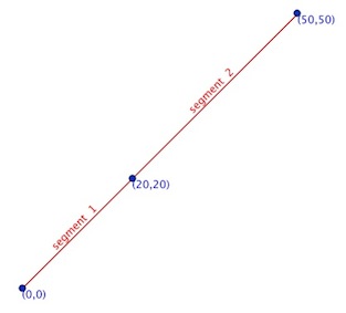
The resulting line is made up of two segments: (0,0) to (20,20) and (20,20) to (50,50)

-
Thanks but this doesn't give me an arc, it only gives me a line between three points. Commented Jul 12, 2014 at 0:52
-
1""Oh sorry, a line string" -> what is an arc ? a segment of a LineString ?– geneCommented Jul 12, 2014 at 7:47
-
I found this image after a quick search that hopefully shows what I'm after. I may be using the wrong terminology so I apologise if I'm confusing people. Refer to item "2" in this image: docs.autodesk.com/CIV3D/2013/ENU/images/…. The arc is comprised of multiple line segments. Commented Jul 21, 2014 at 11:34
-
In item 2, its is a polyline with three segments (look above)– geneCommented Jul 21, 2014 at 14:04
-
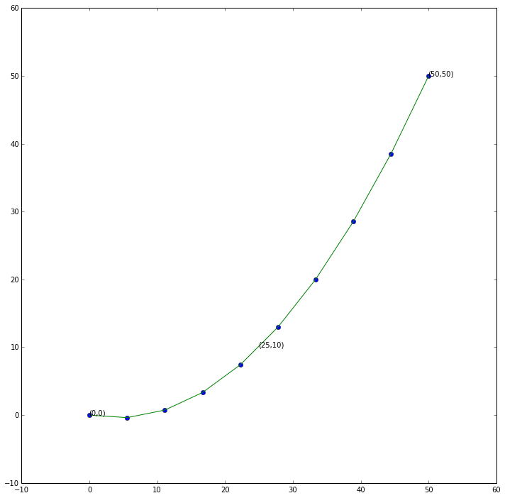
Building on @gene 's answer above if you're looking to approximate a curve as a sequence of points using spline interpolation. In Python you can do this through the scipy.interpolate library. Particularly 1d interpolation.
For example
import numpy as np
import scipy.interpolate

coords = np.array([[0, 0], [25, 10], [50, 50]])

#The curve fits as a quadratic equation on three points
f = scipy.interpolate.interp1d(coords[:, 0], coords[:, 1], kind='quadratic')

#New points will be evenly distributed along x
new_x = np.linspace(np.min(coords[:, 0]), np.max(coords[:, 0]), 10)
new_y = f(new_x)

new_coords = np.vstack([new_x, new_y]).T

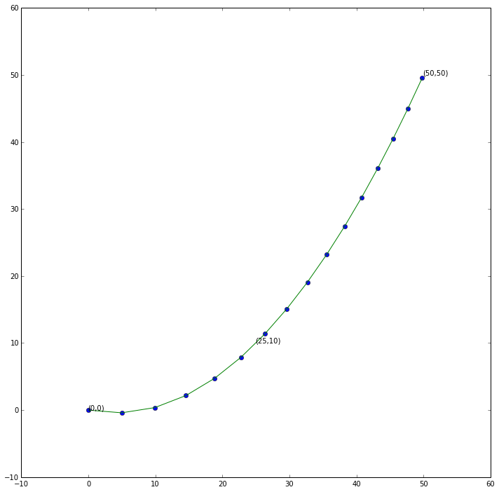
With a bit more work (play with shapely.interpolate) you can get a curve in segments of equal like so:
from shapely.geometry import Point, LineString, mapping

fine_x = np.linspace(np.min(coords[:, 0]), np.max(coords[:, 0]), 1000)
fine_y = f(fine_x)

fine_coords = zip(fine_x, fine_y)
fine_line = LineString(fine_coords)

even_line = LineString([
    np.array(fine_line.interpolate(i))
    for i in np.arange(0, fine_line.length, 5) #points 5 units apart
])

-
-
Thanks but I'm looking to generate segments using three coordinates; start of arc, end of arc and centre of arc. Commented Jul 24, 2014 at 11:03
-
@Stodge In which case take a look at this answer on Stack Overflow - it should have exactly what you're after Commented Jul 24, 2014 at 15:43
-
The result is not a LineString with three points. Otherwise you can also use all the interpolation algorithms.– geneCommented Jul 24, 2014 at 15:57
-
@gene Yeah. I'm now thinking Stodge is after a circular arc as generalised to a line string. After looking at it a couple of times, in the picture supplied in the comment to your solution I think the centre point of the arc is the green circle to the left of the "2" Commented Jul 24, 2014 at 16:05
