2

I have downloaded bathymetric data into QGIS. In order to use it I need to conduct a float to raster conversion. I have not been able to find how to do this on any of the forums. I have unsuccessfully tried using 'Raster' --> 'Conversion' --> 'Translate' option but still have found no attributes in my attributes table.

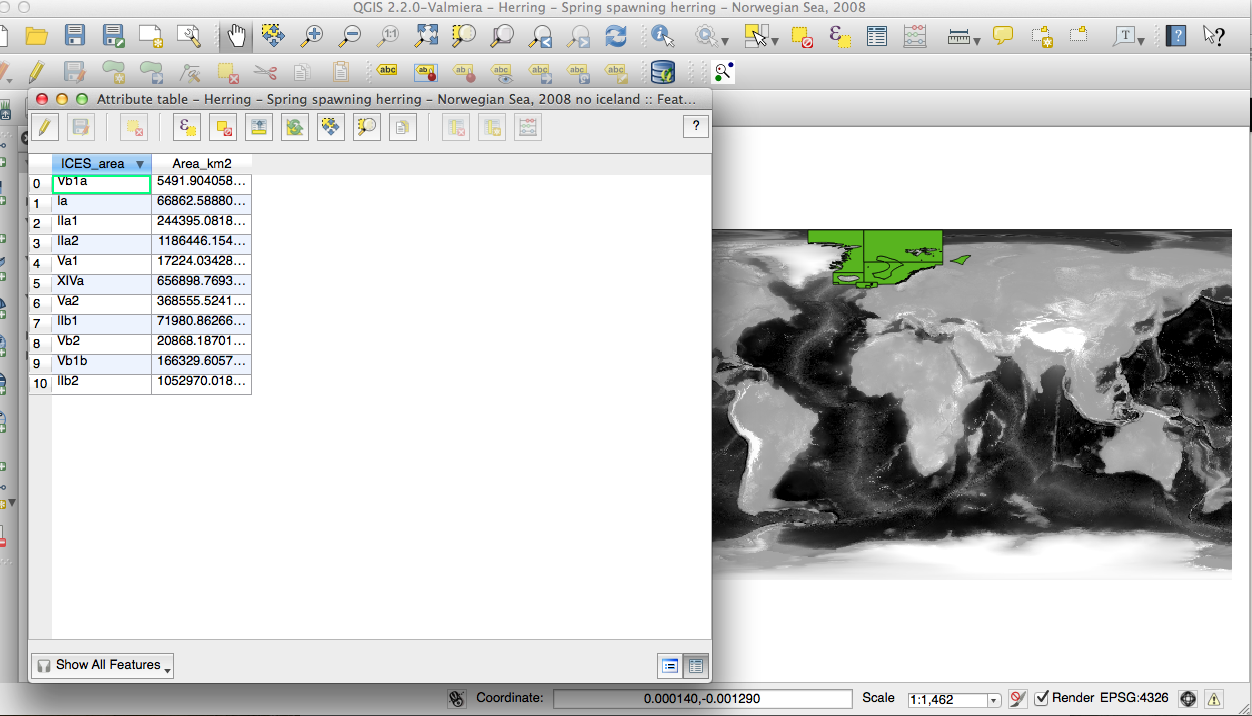
Here is a shot of the float file (grey shades file in the background) and the habitat area in green. I have also opened the attribute table of the habitat area file for you to see, which shows the all the statistical areas included, the sum of which make up the entire habitat area. Eventually i am planning to use interpolation plugin (TIN) to calculate HABITAT volume. That is the purpose of this exercise.
enter image description here

3
  • I don't exactly understand what kind of output data do you need from your input raster (I just guessed that you have an input raster because of the tool you tried to use), but there is a SAGA plugin in the processing tool-bar dedicated to data conversion. SAGA -> Grid - Tools -> Convert data storage type Commented Sep 18, 2014 at 9:47
  • Also as @jzol has pointed out in this post (gis.stackexchange.com/questions/114184/…), you can fine-tune the Gdal Translate tool with the -scale src_min src_max parameters. Commented Sep 18, 2014 at 9:58
  • I have downloaded the float file from ngdc.noaa.gov/mgg/global/relief/ETOPO1/data/ice_surface/… . In the data description they tell "ESRI ArcGIS users should use the f4 version and convert using 'Float to Raster". Eventually i would like to somehow connect this depth information to specific fish habitat areas so that i can calculate habitat volume. I believe in order to do this i can use interpolation plugin (TIN). I will upload a photo of an example of a habitat area for you.
    – anina
    Commented Sep 18, 2014 at 12:22

1 Answer 1

3

This note you've quoted is devoted especially to ArcGIS users - Float to Raster tool is dedicated to convert float files (float reffers to file format not values type) to ArcGIS raster dataset suitable to perform further analisys in ESRI's ecosystem.

Using QGIS you can skip this step. Of course if you wish to convert float file to any other grid format - gdal_translate will do the work.

To derive volume try GRASS module r.volume of course combine it with some clipping and/or other analisis.

Your Answer

By clicking “Post Your Answer”, you agree to our terms of service and acknowledge you have read our privacy policy.

Not the answer you're looking for? Browse other questions tagged or ask your own question.