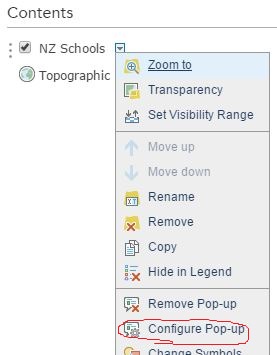
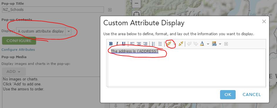
I have an ArcGIS webmap with school boundaries. I would like to provide a link in the pop up that takes a public user to a free routing website like Bing or Google with the directions to their neighborhood school already filled in.
http://agtrail.rivcoca.org/ The County of Riverside has what I am talking about on their webmaps.
Is this something I will have to create a url for for each school and add it to each school boundary attribute? Or is there a faster way?
I know ESRI can do routing directions but they use up credits and I want to do this without costing my district any more money.
My scripting skills are very basic but if coding is the only way to do this I am willing to try my best.


