26

I'm looking for an open source GIS that supports viewing and editing of CityGML models.

So far, I've found a list of open source applications that support CityGML, but they all seem to be stand-alone applications, that don't integrate with common GIS systems: http://www.citygmlwiki.org/index.php/Open_Source.

I would also be interested in your experience with CityGML in a GIS (also commercial) context.

3
  • I asked a question about this a little while ago - it wasn't specific to opensource tools though. gis.stackexchange.com/questions/6406/…
    – djq
    Commented Aug 15, 2011 at 13:48
  • 1
    You can view cityGML with gvSIG 3D, see gvsig3d.blogspot.com/2011/09/… but I haven't tested to see if you can edit them so I didn't post as a possible answer. The video shows scaling and repositioning of the 3d object; I don't know where the edits are stored: in the view as part of the layer symbology, or hard coded edits into the citygml file?
    – SaultDon
    Commented Sep 21, 2011 at 18:02
  • 1
    citygmlwiki.org/index.php/Free_Software
    – acanimal
    Commented Jan 5, 2012 at 19:04

4 Answers 4

3

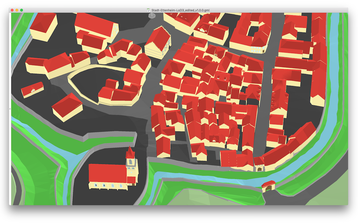
azul may also be of your interest: it is a CityGML viewer developed for macOS.

It is free (on the App Store and Github), and it is open-source. It does not have editing functions though.

enter image description here

You might also want to check and follow the list of CityGML software on the new citygml.org page.

2

3D City DB offers multiple open tools, including a database:

The 3D City Database has been realized as Oracle Spatial/Locator and PostgreSQL/PostGIS database schema, supporting following key features:

and web viewer

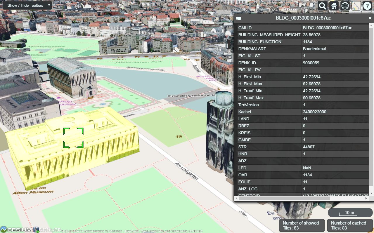
The 3DCityDB-Web-Map-Client is a web-based front-end of the 3DCityDB for high-performance 3D visualization and interactive exploration of arbitrarily large semantic 3D city models in CityGML. It utilizes the Cesium Virtual Globe as its 3D geo-visualization engine based on HTML5 and Web Graphics Library (WebGL) to provide hardware acceleration and cross-platform functionalities like displaying 3D graphic contents on web browsers without the needs of additional plugins.

enter image description here

1
  • How would you edit CityGML models with 3DCityDB? Commented Sep 7 at 8:16
1

deegree3D (part of a broader FOSS geospatial project, deegree) looks like it might work for you. Probably depends a lot on what features you need. Unfortunately I haven't tried it, so I can't comment on its use or reliability.

-1

Just to add there is a data warehouse tool FME. It's a set of tools, very easy to use, also have extensive customer support since it's a commercial software. You can use it for free if you are a student.

Your Answer

By clicking “Post Your Answer”, you agree to our terms of service and acknowledge you have read our privacy policy.

Not the answer you're looking for? Browse other questions tagged or ask your own question.