1

I have cad file (.dwg) which contains the geometry and the attributes are in the tables of access (.mdb) database. The common FIELD in both of them is "HANDLE".

How do I convert these into a geodatabase taking the geometry from the CAD and the attributes from the .mdb?

I have tried first by converting the cad into feature class and then JOIN it with the mdb tables, but the fields are getting repeated. How to update or copy the attributes from the tables into the geodatabase?

1 Answer 1

1

This is normal behaviour for a Join - ALL fields are returned from both the feature class and the joined table.

enter image description here

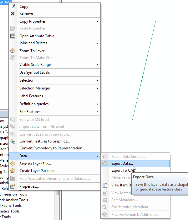
You can now export that joined dataset to a new feature class
In ArcMap from the Right-Click context menu:
enter image description here

Or using the ArcToolbox tool Feature Class to Feature Class.

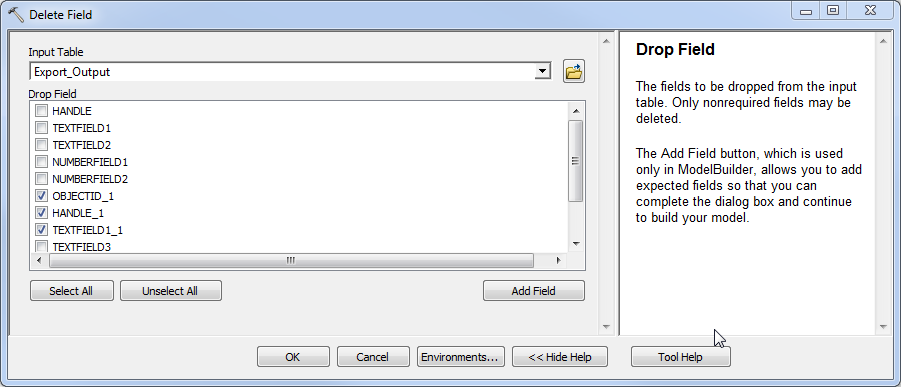
With this new feature class created, you can now use the Delete Field tool to remove any uneeded repeated fields. (Please note that Delete Field modifies the input feature class, it does not create a new output!) enter image description here

End result after the Delete Field.
enter image description here

1
  • Thank you @Midavalo for the detailed answer. i am familiar with this process, i have tried it before, i want to know whether if there is any other way of doing the work in fewer steps, any other way other than using the JOIN?
    – Mdm83
    Commented Feb 7, 2016 at 6:06

Your Answer

By clicking “Post Your Answer”, you agree to our terms of service and acknowledge you have read our privacy policy.

Not the answer you're looking for? Browse other questions tagged or ask your own question.