Is it possible to open a wms in arcgis and then to cut it in a small region (20km * 20km) which i want and finally i make a tiff file?
-
3Please take the tour: gis.stackexchange.com/review and edit your question to include what you have tried and what it is that you are having problems with/any errors that are occurring, etc.– MaryBethCommented Mar 31, 2016 at 23:30
-
the simple answer is yes, please add what you have tired and what is not working for you.– Ian TurtonCommented Apr 1, 2016 at 15:22
2 Answers
In ArcMap, add the WMS and turn it on then zoom to the region you want to export.
Click the File->Export Map... menu.
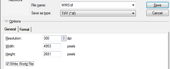
In the General tab, change format to TIFF, adjust resolution if required, tick Write World File (world file not required if GeoTIFF tags are included).

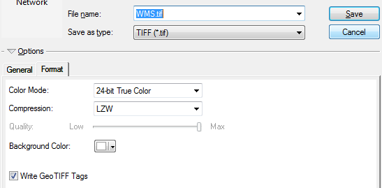
In the Format tab, add compression if desired and tick Write GeoTIFF Tags (GeoTIFF tags not required if world file is written)

One way to do this after WMS is added, if you need several exports, in batch would be:
- Create polygon grid layer based on desired extent, see link below for options how to do this Creating spatially projected polygon grid with ArcMap?
- Adjust layout height width ratio to be similar to grid layer feature and adjust data frame edges to be flush with layout boarder
- With grid layer, setup data driven pages, turn off grid, and batch export each grid extent to geotiff with file>export data driven page option
