2

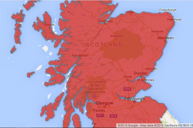
My goal is to render the country boundary of Scotland in KML format so I can use it with Google Fusion Tables. I’ve so far managed to do this but with chunks of its surrounding islands missing, so what am I doing wrong? How do I render the FULL boundary in KML without missing chunks of it?

  • I’ve tried using SHP2KML to convert the original shapefiles but I keep getting a render of Guinea instead!?
  • I’ve also used QGIS which I really like, especially as I don’t have to backdate my machine to use it unlike SHP2KML, but it produces the result below.
  • And I’ve used the converter.mygeodata.eu website which also produced the below result.

How can I render the full boundary of Scotland, and why are there missing chunks when I try to do it?

I've uploaded the original shapefile here.

My patchy Scottish polygon (close-up):

enter image description here

2 Answers 2

1

Try ogr2ogr

ogr2ogr -f KML scotland.kml infuse_ctry_2011.shp

However, your shapefile is very detailed and the output KML is huge (54 MB). Most apps won't be able to handle such large KML files.

Do you need all the details or can you simplify the geometry a bit to reduce the number of vertices?

Try

ogr2ogr -f KML -simplify 10 scotland.kml infuse_ctry_2011.shp

This reduces accuracy to 10 meter and reduces file size to less than 10 MB

1
  • Thank you for the tip @Thomas. After working out how to install GDAL and use ogr2ogr, I tried converting the .shp file with and without -simplify but I get the following result: link What could I be doing wrong? Did this happen because I only converted the .shp file inside the original .zip shapefile? Is there a way for me to convert the full .zip file to kml - if necessary?
    – Sidders
    Commented May 22, 2016 at 8:38
0

Well after much trial and error, the reason I was getting an incomplete Scottish map was because the KML file I was using was still too big, even after using OGR2OGR. Simplifying Scotland's boundaries further using mapshaper.org helped but the polygons/boundary was still incomplete in Google Fusion Tables.

So I've given up on it, and I am using another tool to visualize my map successfully for the time being.

Your Answer

By clicking “Post Your Answer”, you agree to our terms of service and acknowledge you have read our privacy policy.

Not the answer you're looking for? Browse other questions tagged or ask your own question.