3

I have received a dataset projected to Lambert Conformal Conic though it appears to be a custom projection. The layer properties:

Projected Coordinate System: Lambert_Conformal_Conic

Projection: Lambert_Conformal_Conic

false_easting: 600000.00000000

false_northing: 2200000.00000000

central_meridian: 0.00000000

standard_parallel_1: 45.89891896

standard_parallel_2: 47.69601450

latitude_of_origin: 46.80000000

Linear Unit: Meter

Geographic Coordinate System: GCS_unnamed ellipse

Datum: D_unknown

Prime Meridian: Paris

Angular Unit: Degree

This is causing me issues when trying to integrate other datasets in WGS84 and reprojecting.

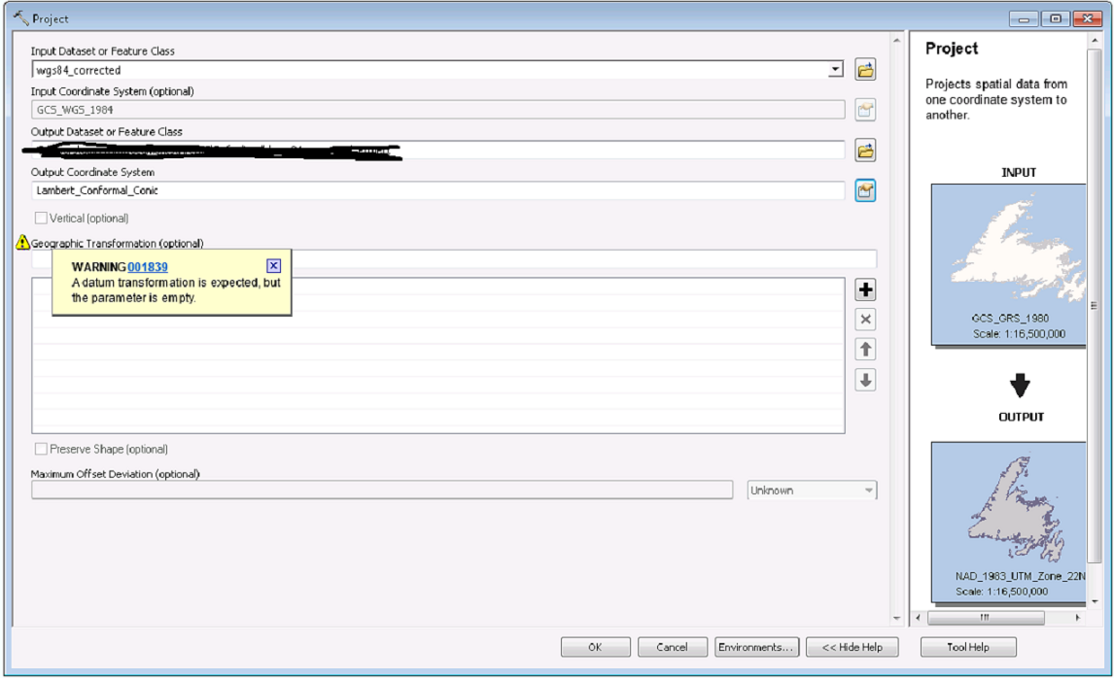
Edit: here is the processing error in ArcGIS 10.4:

warning 001839

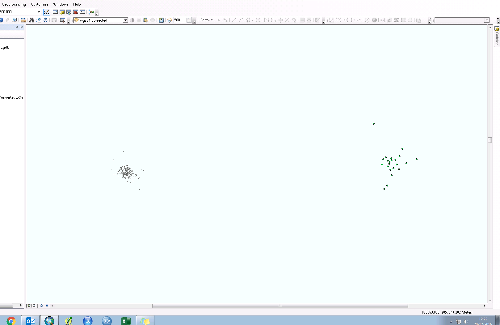
And here is the output if I proceed with the projection (data should overlay):

enter image description here

Is there a solution to this other than trying to find out the original source for the dataset?

1
  • Please specify the issues you have with the projection, possibly with a screenshot.
    – til_b
    Commented Dec 20, 2016 at 12:17

2 Answers 2

3

Instead of modifying the existing definition you have, you should instead use NTF France II (degrees) or NTF Lambert Zone II. Either of these are based on NTF in degrees and relative to Greenwich prime meridian. This will make your life much easier than using the Paris prime meridian.

Both definitions are located in the Projected Coordinate Systems, National Grids, France folder.

Because you're not setting a transformation, the software is not converting from the Paris prime meridian to the Greenwich one, thus the east-west offset.

Using the NTF-based definition will allow the software to find a transformation between NTF and WGS84.

The two-standard-parallels version that you have was probably created for use in a software package that doesn't support a Lambert conformal conic (LCC) algorithm that accepts a latitude of origin plus a scale factor. This version of LCC is commonly used in Europe and elsewhere.

2

Your projection is very similar to NTF France II (degrees), apart from the fact that your projection is secant while NTF is tangent. I guessed that it is in France because of the central meridian and the latitude of origin.

My best guess would therefore be that your spheroid is Clarke_1880_IGN.

If you use this one, I recommend you to modify the value of your central meridian to 2,337229166666667 (the longitude of Paris meridian) because the Prime meridian of your unknown ellipse is Paris, but the prime meridian of the standard clarke datum is Greenwich. This is the main reason for the observed coordinate shift. You could also create a custom datum but I think that it is safer to modify the value of the central meridian.

1
  • 1
    The problem with switching just the ellipsoid is that there's still a GeoCRS (datum) shift that will be missing, and the data will likely be offset.
    – mkennedy
    Commented Dec 20, 2016 at 19:13

Your Answer

By clicking “Post Your Answer”, you agree to our terms of service and acknowledge you have read our privacy policy.

Not the answer you're looking for? Browse other questions tagged or ask your own question.