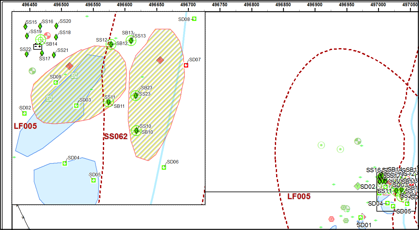
I'm working with a scripted Mapbook in ArcMap; There are several pages that require an inset map to show detail of a cluster of points in the main data frame. The cluster of points comes from one layer that has labels turned on. Only labels for features that are not in the inset data-frame should be turned on.
In the example below, only the label for SD01 would show in the lower-right, as it does not fall within the inset data frame.
My initial thoughts are to script a select-by-location (selecting points within the inset data-frame extent), building a query based off of the selection results, and applying that query as a label definition query in the main data frame. This seems overly complicated for the task at hand.


