2

enter image description here

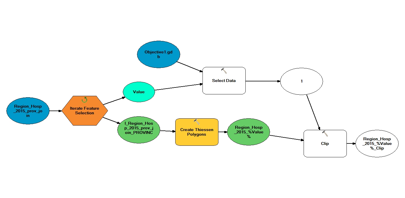
What I am trying to achieve: I have a dataset of ~3000 health facilities in 52 districts. I want to draw Thiessen polygons around the health facilities which conform (are contained within) to the district boundaries. I am able to select all the health facilities in each district district using iterate feature selection and draw Thiessen polygons around them. I have also created a feature class file for each district to use as the clipping feature for each set of thiessen polygons. The name of these files is identical to the output of the %Value% inline variable produced by the iterative function.

I would really like to automate the clipping of the thiessen polygons. I have tried various methods:

  1. Using the inline variable value as a child in the select data tool (does not work as value is not a member of gdb)
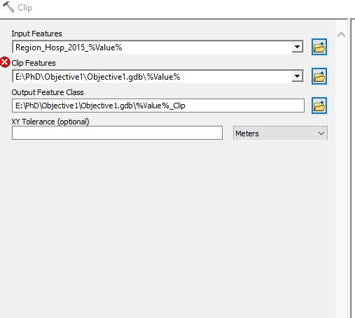
  2. using the inline variable to specify the name of the clipping feature in the clipping tool e.g E:\PhD\Objective1\Objective1.gdb\%Value%

Any ideas?

enter image description here

1 Answer 1

1

You are using the wrong select tool. Select extracts data from it's input to a new featureclass.

It is not entirely clear but if you have created a SINGLE featureclass which contains your district boundaries and this dataset has a field which contains the name of each district which you have used in your iterator then you want to use the select by attribute tool. You would set the where clause to be something like:

Districtfieldname = "%Value%"

This would select a single polygon and as all geo-processing tools honor selections it would be the polygon that clips the thiessen polygons.

1
  • Thank you Hornbydd - Works perfectly now. Much appreciated. It has probably saved me days of mindless work. :)
    – Harrydoc
    Commented Aug 30, 2017 at 8:46

Your Answer

By clicking “Post Your Answer”, you agree to our terms of service and acknowledge you have read our privacy policy.

Not the answer you're looking for? Browse other questions tagged or ask your own question.