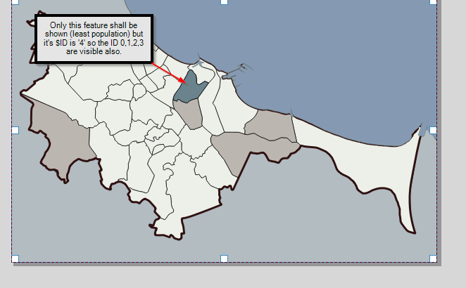
I try to make a set of maps using QGIS Atlas. My maps will consist of selected feature with it's attributes (using $id = @atlas_featureid, and that's working). Basically - districts in particular city with population, from the lowest to highest. But I want also to show the previous shown features grayed out/in different color/etc. Like here GeoGIF.
I've found that the solution could be a formula $id <= @atlas_featureid. But it's not working properly in my case. The problem I've found is that ID of features in my project does not correspond to the order of features I want to show.
In my project - the order of maps generated with atlas is based on population value, from lowest to highest. How to handle this problem?

