2

I am working on estimating Canopy height of mangrove. I want to employ ASTER level 1A or 1B data to generate Digital Surface Model (DSM). But after I searched it in Google, I cannot find an existed method to generate a DSM. So, how do I generate a DSM using ASTER level 1A/B data? Or, can the ASTER data (level 3 DEM) set be considered as a digital surface model (DSM) which provides heights of the surface objects?


Discussion: After thinking for a while, I understand ASTER has theer subsystems: VNIR (visible and Inferred band), SWIR and TIR. The VNIR has the 3N and 3B band which can be applied to generate DEM. Moreover, DSM is a subset of DEM. Since the channels cannot penetrate canopy to reflect ground, the level 1 data of ASTER indicates the surface height information instead ground information. Thus, the raw data can generate digital surface model.

2
  • Do you have access to ArcGis? Which resolution is required? This could be a solution for you. And as far as I know, the ASTER GDEM is free, provided by the JPL.
    – sequoia
    Commented Jan 31, 2018 at 19:28
  • Thanks for your reply @sequoia. Actually, I want to generate the surface height (i.e. Canopy height) using ASTER. However, I have no idea about whether the DEM data (level 3) of ASTER can be considered as a DSM. If not, is any way to generate a DSM using ASTER low level data (level 1a)?
    – Yuhao Wu
    Commented Jan 31, 2018 at 20:01

1 Answer 1

3

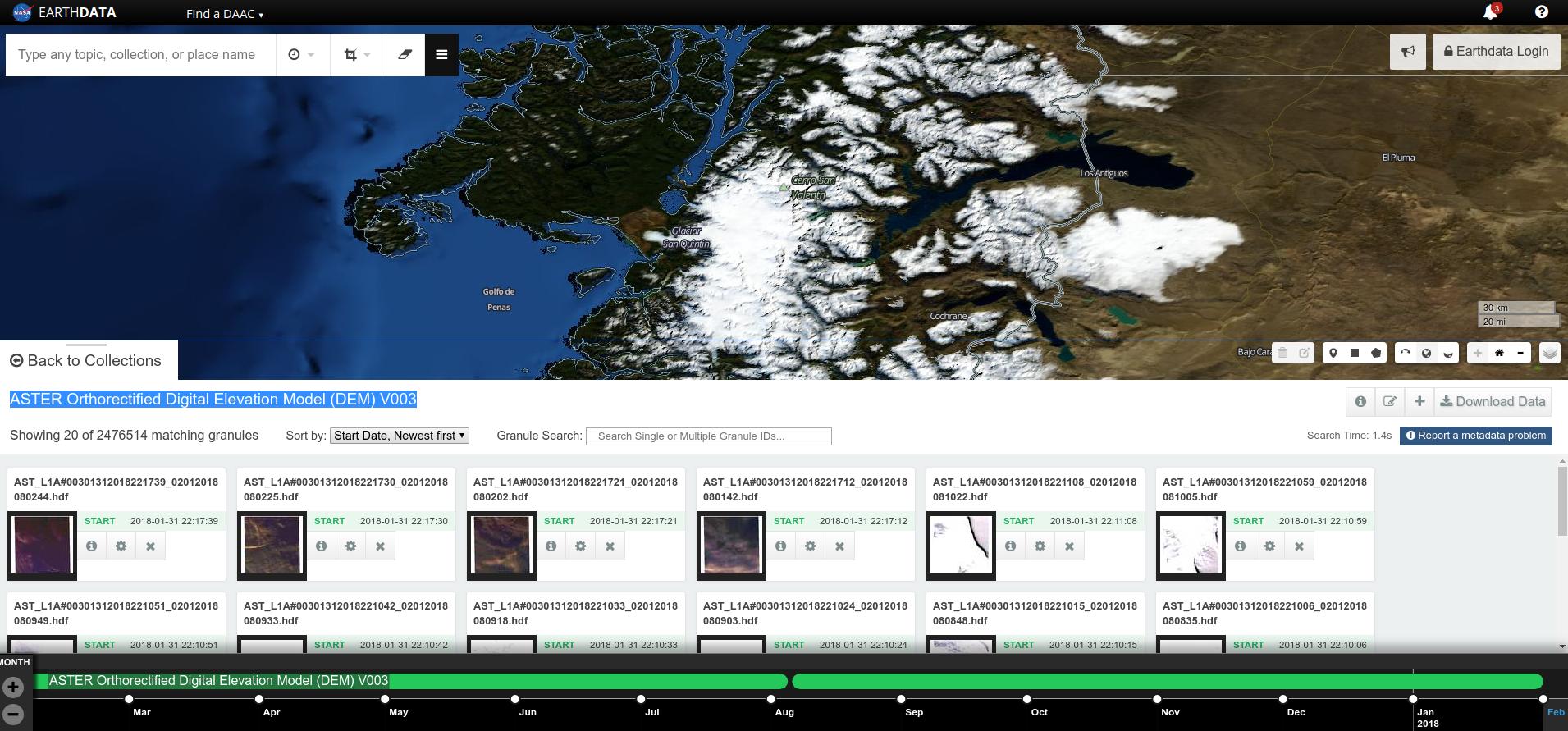
You need ASTER L1A data. L1B doesn't include the band 3B that is needed for DEM generation. You can download for free DEMs generated for any available ASTER scene from EarthData you have to look for the product "ASTER Orthorectified Digital Elevation Model (DEM) V003" (screenshot below)

As you say ASTER DEMs will map the top of the canopy.

If you want to generate the DEMs yourself from L1A data, you need a software with stereoscopy capabilities. I've done it in ENVI, but there are many other options, including free ones.

enter image description here

2
  • Thanks for your answer and sorry for reply late. The reason why I want to generate the DEM by myself is that I have to obtain the absolute elevation. But I am not sure the level 3 which you mentioned is the absolute DEM instead of relative DEM.
    – Yuhao Wu
    Commented Mar 7, 2018 at 19:43
  • @y494wuRS You welcome. I'm pretty sure it is an absolute DEM. You should double check, but I think it is. Commented Mar 7, 2018 at 20:01

Your Answer

By clicking “Post Your Answer”, you agree to our terms of service and acknowledge you have read our privacy policy.

Not the answer you're looking for? Browse other questions tagged or ask your own question.