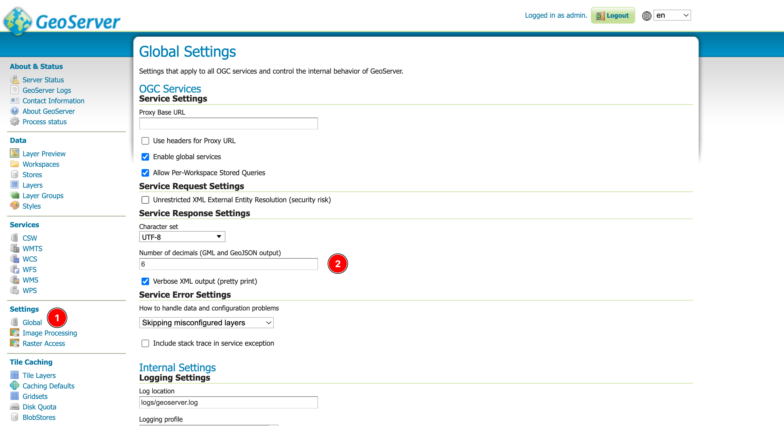
I'm calling the geo:centroid WPS process from Geoserver. If I set the output type to "application/json" the returned values has only 4 digits after the dot (e.g xx.xxxx), but if I set the output type to "text/xml" the returned values has more digits after the dot (e.g xx.xxxxxxxxxxxxxxx). My question is how to make the "application/json" returned values have more precisions (more digits after the dot).
Here is an example:
1- application/json
<?xml version="1.0" encoding="UTF-8"?>
<wps:Execute version="1.0.0" service="WPS" xmlns:xsi="http://www.w3.org/2001/XMLSchema-instance" xmlns="http://www.opengis.net/wps/1.0.0" xmlns:wfs="http://www.opengis.net/wfs" xmlns:wps="http://www.opengis.net/wps/1.0.0" xmlns:ows="http://www.opengis.net/ows/1.1" xmlns:gml="http://www.opengis.net/gml" xmlns:ogc="http://www.opengis.net/ogc" xmlns:wcs="http://www.opengis.net/wcs/1.1.1" xmlns:xlink="http://www.w3.org/1999/xlink" xsi:schemaLocation="http://www.opengis.net/wps/1.0.0 http://schemas.opengis.net/wps/1.0.0/wpsAll.xsd">
  <ows:Identifier>geo:centroid</ows:Identifier>
  <wps:DataInputs>
    <wps:Input>
      <ows:Identifier>geom</ows:Identifier>
      <wps:Data>
        <wps:ComplexData mimeType="application/json">
            <![CDATA[
        {
  "type": "LineString",
  "coordinates": [
    [
      [
        0,
        0
      ],
      [
        10.25124,
        0.257741
      ],
      [
        10.578814,
        10.255447
      ]
    ]
  ]
}
]]>
        </wps:ComplexData>
      </wps:Data>
    </wps:Input>
  </wps:DataInputs>
  <wps:ResponseForm>
    <wps:RawDataOutput mimeType="application/json">
      <ows:Identifier>result</ows:Identifier>
    </wps:RawDataOutput>
  </wps:ResponseForm>
</wps:Execute>
it returns
{
  "type": "Point",
  "coordinates": [
    7.7375,
    2.6609
  ]
}
2- text/xml
<?xml version="1.0" encoding="UTF-8"?>
<wps:Execute version="1.0.0" service="WPS" xmlns:xsi="http://www.w3.org/2001/XMLSchema-instance" xmlns="http://www.opengis.net/wps/1.0.0" xmlns:wfs="http://www.opengis.net/wfs" xmlns:wps="http://www.opengis.net/wps/1.0.0" xmlns:ows="http://www.opengis.net/ows/1.1" xmlns:gml="http://www.opengis.net/gml" xmlns:ogc="http://www.opengis.net/ogc" xmlns:wcs="http://www.opengis.net/wcs/1.1.1" xmlns:xlink="http://www.w3.org/1999/xlink" xsi:schemaLocation="http://www.opengis.net/wps/1.0.0 http://schemas.opengis.net/wps/1.0.0/wpsAll.xsd">
  <ows:Identifier>geo:centroid</ows:Identifier>
  <wps:DataInputs>
    <wps:Input>
      <ows:Identifier>geom</ows:Identifier>
      <wps:Data>
        <wps:ComplexData mimeType="application/json">
            <![CDATA[
        {
  "type": "LineString",
  "coordinates": [
    [
      [
        0,
        0
      ],
      [
        10.25124,
        0.257741
      ],
      [
        10.578814,
        10.255447
      ]
    ]
  ]
}
]]>
        </wps:ComplexData>
      </wps:Data>
    </wps:Input>
  </wps:DataInputs>
  <wps:ResponseForm>
    <wps:RawDataOutput mimeType="text/xml">
      <ows:Identifier>result</ows:Identifier>
    </wps:RawDataOutput>
  </wps:ResponseForm>
</wps:Execute>
it returns
<?xml version="1.0" encoding="UTF-8"?>
<gml:Point xmlns:gml="http://www.opengis.net/gml" srsDimension="2" xmlns:xs="http://www.w3.org/2001/XMLSchema" xmlns:sch="http://www.ascc.net/xml/schematron" xmlns:xlink="http://www.w3.org/1999/xlink">
    <gml:pos>
        7.737501114169446 2.6609131596654136
    </gml:pos>
</gml:Point>

