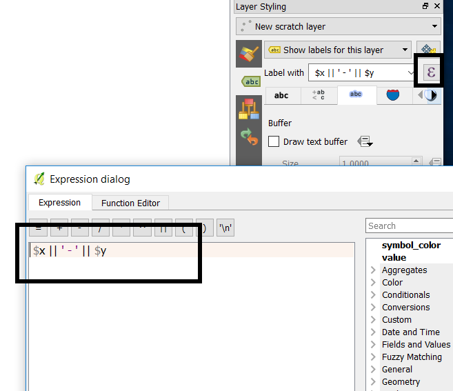
I am working on a school project that requires us to have a map with the points indicating different station with its coordinates appearing as a label. I just don't know how to do it?
I think it could be possible but we just started using QGIS so I know very little.

