8

I have a collection of photos (already geotagged in EXIF) and I'd like to put thumbnails of these pictures on a map (at the location where they were taken).

Just looking for a static visualisation of a map with picture thumbnails - no need for any interactivity (the thumbnails need not to be clickable or mouse-overable), but I do need a way to control the size of the thumbnails (but it can be a global setting that applies to all the pictures). There would be only a handful of thumbnails on a map.

I am new to QGIS, and hoped that I could accomplish this by creating raster layers from .jpg images - and although the pictures are read into QGIS and the coordinates recognised (in Properties), I don't see the picure in the right place and I cannot resize them.

I tried looking into eVis, but that also doesn't seem to do what I want.

Oddly enough, also in Google I cannot find any examples of QGIS-made maps that have these .jpg thumbnails on them. With all the dazzling options in QGIS, surely there must be a simple way to achieve this?

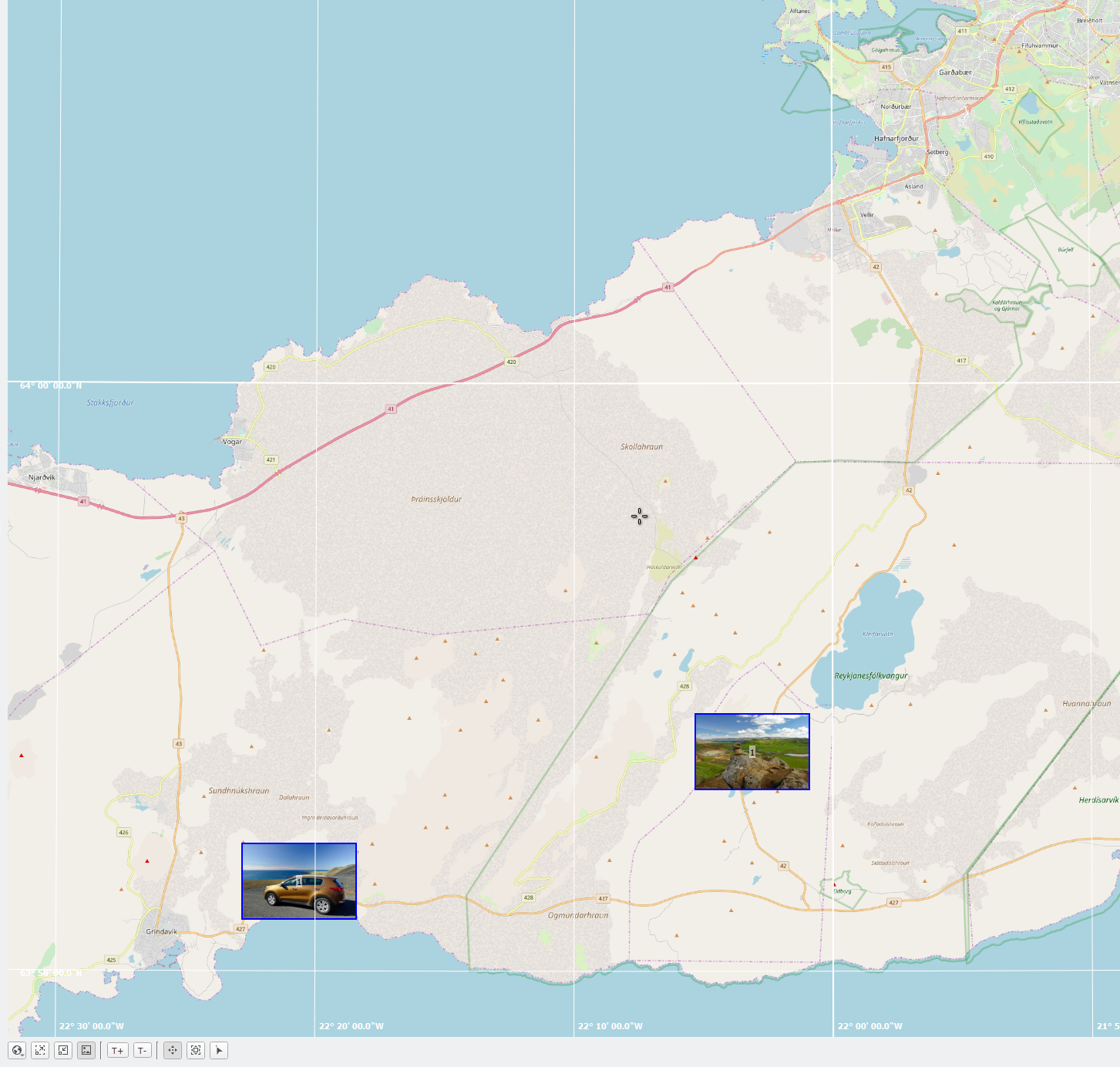
Edit: While still researching this, I came across the digiKam application (digikam.org) that does exactly what I would like to do in QGIS. It puts photos on a map layer, and lets you change the size of thumbnails (see screenshot) enter image description hereUnfortunately, the thing it doesn't do is read GPX files and other GIS functionality...
3
  • 1
    Probably the ImportPhotos plugin is not exactly what you are looking for. But it can be a first approach. Commented Dec 14, 2018 at 5:23
  • That was the first thing I tried. But it does not put photo thumbnails on the map - it just puts icons on the map that can then show individual photos when clicked. Not what I am after: I need a map that is showing all jpg thumbnails.
    – Arjen
    Commented Dec 14, 2018 at 11:20
  • I installed QGIS 3.6 and imported plugin ImportPhotos but the images don't show on the map?
    – fel
    Commented Mar 8, 2019 at 1:53

2 Answers 2

14

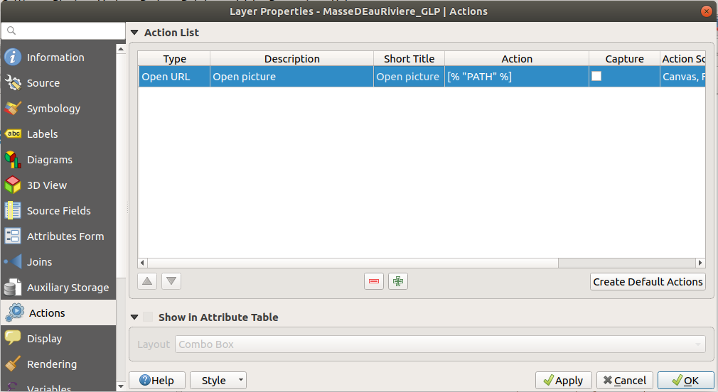
In QGIS 2, you can use layer actions to open the file with the default image viewer if you have the filepath in your attribute table.

QGIS Layer actions

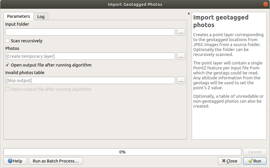
Since QGIS 3.2, you can use the "import geotagged photos" algorithm in the Processing toolbox. It creates a point layer. Then use the layer actions described above. You will not be able to display pictures like in Digikam, to display pictures on the map.

Import geotagged pictures

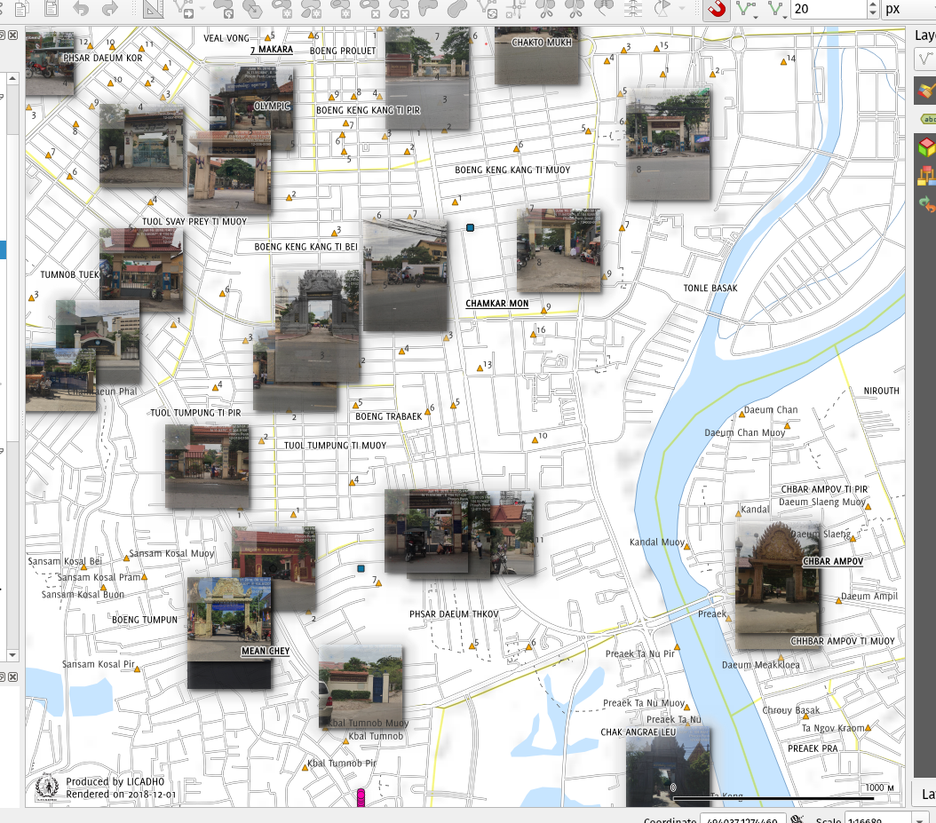
Since QGIS 3.6, you will be able to display your pictures on the map.

Rasters markers in QGIS 3.6.

1
  • That's it! Thank you for pointing that out. I'll be the one to download v3.6 as soon as it comes out!
    – Arjen
    Commented Dec 14, 2018 at 14:47
6

Now that QGIS 3.6 is out, this is easy, at least the symbology part. (Others have suggested ImportPhotos plugin for getting the photos in in the first place.)

Once you have a point layer with each photo's name and/or URL in an attribute, style the layer with Raster Image Marker as the symbol layer type. Then in the data-driven override on the right, specify that attribute as the variable. Set the desired size, in mm/ground dimensions/whatever below to scale the photos to consistent size.

I believe this worked since QGIS 3.x (x=2 or 4?) for photo files, and now works for URLs too. See my answer at Visualization of pictures for points in QGIS for more info and an example.

2
  • Great - so it turns out I did not have to wait for v3.6 after all. My pictures are all local, and using your instructions I now have what I was looking for (and was originally asking for in this thread)!
    – Arjen
    Commented Mar 30, 2019 at 16:10
  • This is excellent. I still needed to fiddle a bit around but it worked like charm!
    – Vincé
    Commented Feb 10, 2022 at 18:58

Your Answer

By clicking “Post Your Answer”, you agree to our terms of service and acknowledge you have read our privacy policy.

Not the answer you're looking for? Browse other questions tagged or ask your own question.