In a stand-alone/external PyQGIS app that I'm developing I've noticed that wms/xyz tiles that are returned as jpegs don't render on the map canvas but those that return pngs do.
So for example the Google Maps, layer=m which returns pngs does render fine.
provider='type=xyz&url=http://mt1.google.com/vt/lyrs%3Dm%26x%3D%7Bx%7D%26y%3D%7By%7D%26z%3D%7Bz%7D&zmax=19&zmin=0'
But the Google Satellite, layer=s which returns jpegs doesn't render, nor does the Bing layer which also returns jpegs render.
provider='type=xyz&url=http://mt1.google.com/vt/lyrs%3Ds%26x%3D%7Bx%7D%26y%3D%7By%7D%26z%3D%7Bz%7D&zmax=19&zmin=0'
I've tried adding an image format parameter, format=image/jpeg but it doesn't make any difference.
provider='format=image/jpeg&type=xyz&url=http://mt1.google.com/vt/lyrs%3Ds%26x%3D%7Bx%7D%26y%3D%7By%7D%26z%3D%7Bz%7D&zmax=19&zmin=0'
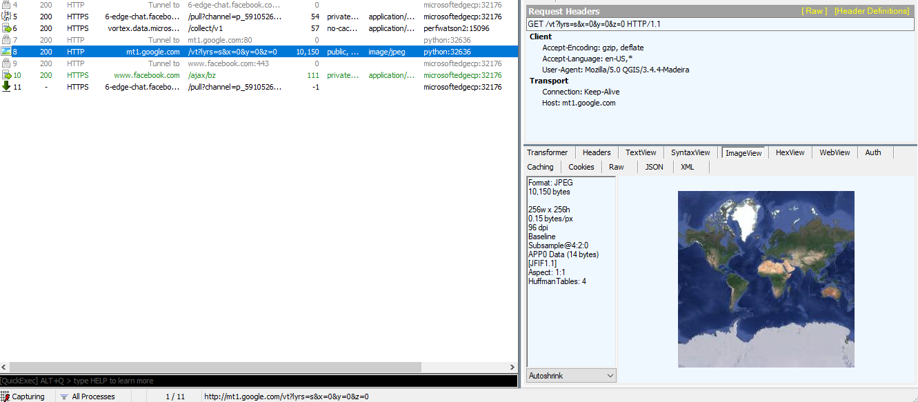
I used Fiddler on Windows to confirm that there were no network issues with the Google Satellite requests and I can see the jpeg tiles being returned successfully. It's actually how I first noticed that the working layers were returning pngs and the non-working layers were all returning jpegs.
Is there some parameter I haven't set for the raster layer to ensure that jpeg tiles are rendered?
The same wms/xyz tile URI, and without the format parameter works fine in QGIS itself, just not in my stand-alone PyQGIS app.
I'm using QGIS 3.4.
Here is a minimal PyQGIS app demonstrating the issue:
from qgis.core import QgsApplication, QgsProject, QgsRasterLayer
from qgis.gui import QgsMapCanvas, QgsLayerTreeMapCanvasBridge

from PyQt5.QtWidgets import QMainWindow
import os

GOOGLE_MAPS_SOURCE = "type=xyz&url=https://mt1.google.com/vt?lyrs%3Dm%26x%3D%7Bx%7D%26y%3D%7By%7D%26z%3D%7Bz%7D&zmax=19&zmin=0"
GOOGLE_SATELLITE_SOURCE = "type=xyz&url=https://mt1.google.com/vt?lyrs%3Ds%26x%3D%7Bx%7D%26y%3D%7By%7D%26z%3D%7Bz%7D&zmax=19&zmin=0"

class WMSTestApp(QMainWindow):

    def __init__(self):
        super().__init__()

        self.canvas = QgsMapCanvas(self)
        self.bridge = QgsLayerTreeMapCanvasBridge(QgsProject.instance().layerTreeRoot(), self.canvas)

        layer = QgsRasterLayer(GOOGLE_SATELLITE_SOURCE, "Test WMS Layer", "wms")
        print("Raster layer is valid?:", layer.isValid())

        QgsProject.instance().addMapLayer(layer)
        self.canvas.setLayers([layer])

        self.setCentralWidget(self.canvas)


QgsApplication.setPrefixPath(os.environ.get("QGIS_PREFIX_PATH", "C:\Program Files\QGIS 3.4\apps\qgis"), True)
qgs = QgsApplication([], True)
qgs.initQgis()

app = WMSTestApp()
app.show()
qgs.exec_()
qgs.exitQgis()
Fiddler showing the successful transmission of the jpeg tile.

