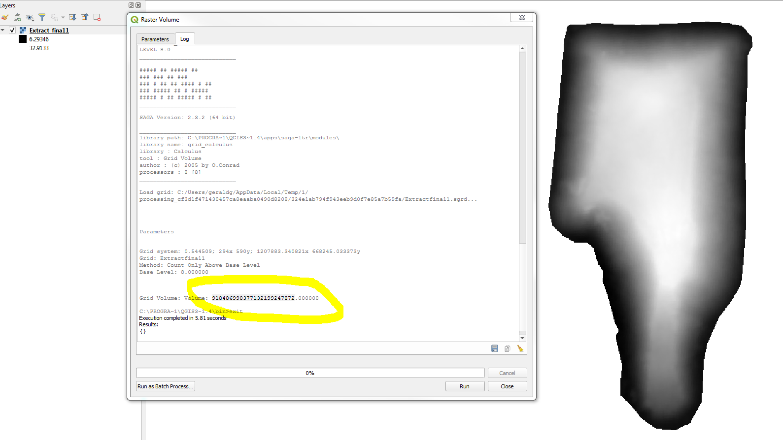
I have a clipped surface using Washington State Plane North (feet) added to a QGIS project using the same CRS. I am trying to calculate the area under this surface (a dirt pile) using SAGA Raster Volume. The volume returned by SAGA is crazy big. I have tried different versions of QGIS and get the same results. The dirt pile has the correct elevation values (in feet above NAVD88). The surface draws in the correct location. Why does this tool return such a high number? Does SAGA Raster Volume not return the volume in map units?
-
I wonder what is the value of Base Level.– user30184Commented Apr 17, 2019 at 20:56
-
@user30184, The elevation of the pad that the pile of dirt is sitting on is 8 ft above the NAVD88 vertical datum. I am interested in the volume of dirt above 8 ft.– GBGCommented Apr 18, 2019 at 4:52
-
1Unfortunately, when a data is on unknown-CRS, SAGA tends to assume it is geographical (latlong) coordinates. Your cell size (0.54 ft) is mistaken as 0.54 degrees (~ 30 miles or 160,000 feet) so the cell volume would be around 160^2 * 10^6 * height (ft). Then SAGA sums up all these cell volumes.– KazuhitoCommented Apr 18, 2019 at 10:15
-
Thanks @Kazuhito. I have installed SAGA proper and created simple test data and I can confirm that your explanation is correct. If you add your comments to an answer I will mark it answered.– GBGCommented Apr 18, 2019 at 20:27
Add a comment
|
1 Answer
Unfortunately, SAGA does not know NAVD88. When the data is given in CRS unknown, SAGA tends to assume it is geographical (latlong) coordinates.
Your cell size (0.54 ft) is mistaken as 0.54 degrees (~ 30 miles or 160,000 feet) so the cell volume would be around 160^2 * 10^6 * height (cu-ft). Then SAGA sums up all these cell volumes.
Alternative options would be:
- If you are using QGIS 3.6 - Raster surface volume tool in the
Processing Toolbox > Raster analysis. - If you are using QGIS 3.0~3.4 - Wait for SAGA 7.3 and use it under Processing Saga NextGen Provider Plugin.
- If you are using QGIS 2 (e.g. 2.18) - Use Raster Calculator to subtract Base Level. Then use Raster layer statistics to calculate SUM.

