1

I am using this DTM: http://ags.cuzk.cz/arcgis2/services/dmr4g/ImageServer/WMSServer?request=GetCapabilities&service=WMS

At ArcGIS I am able to ready pixel value of the raster but at QGIS it doesn't work. Tried this plugins to get the value

  • Point sampling tool
  • Value Tool
  • Profile tool

But the layer looks empty, like no pixel value in there (at ArcGIS there are).

Can anybody try me link to confirm same issue with layer? Maybe I do something wrong.

2 Answers 2

1

I believe the reason you cannot access the values from this DTM is because it is being served as a WMS, which QGIS is unable to obtain data from.

Sometimes some WMS work as WFS if this one does, the second answer here might be of help.

1

I think it is because you use WMS layer which can be served like a tiled image - not "real" DTM. Why not to use SRTM or EU-DEM?

SRTM http://dwtkns.com/srtm30m/

EU-DEM https://www.eea.europa.eu/data-and-maps/data/copernicus-land-monitoring-service-eu-dem

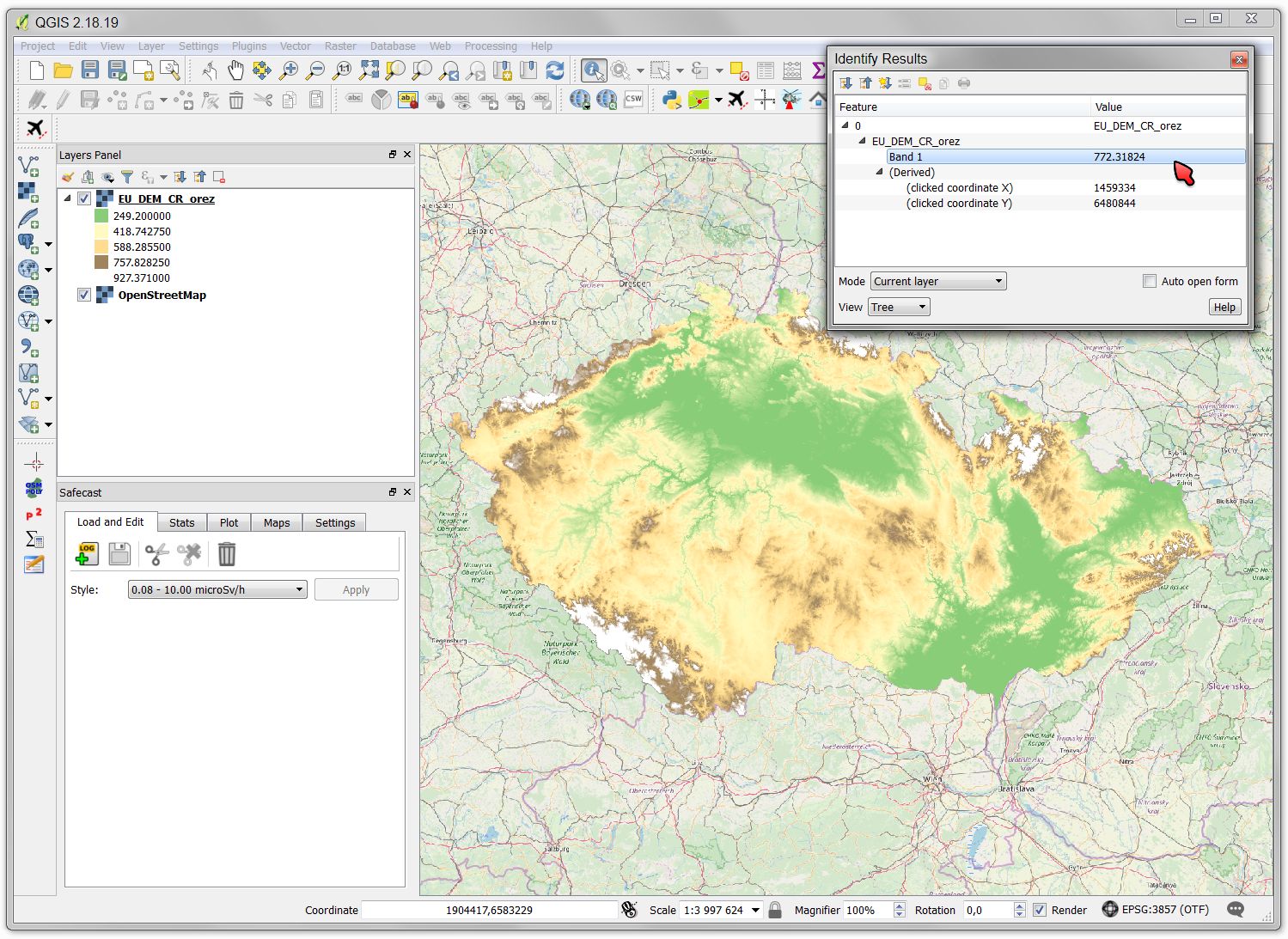
This is an example of using EU-DEM data. I cropped some part using a polygon layer in SAGA-GIS and then applied custom styling in QGIS (nothing difficult). It is native offline dataset so I can perform various operations with it:

EU DEM example

Your Answer

By clicking “Post Your Answer”, you agree to our terms of service and acknowledge you have read our privacy policy.

Not the answer you're looking for? Browse other questions tagged or ask your own question.