4

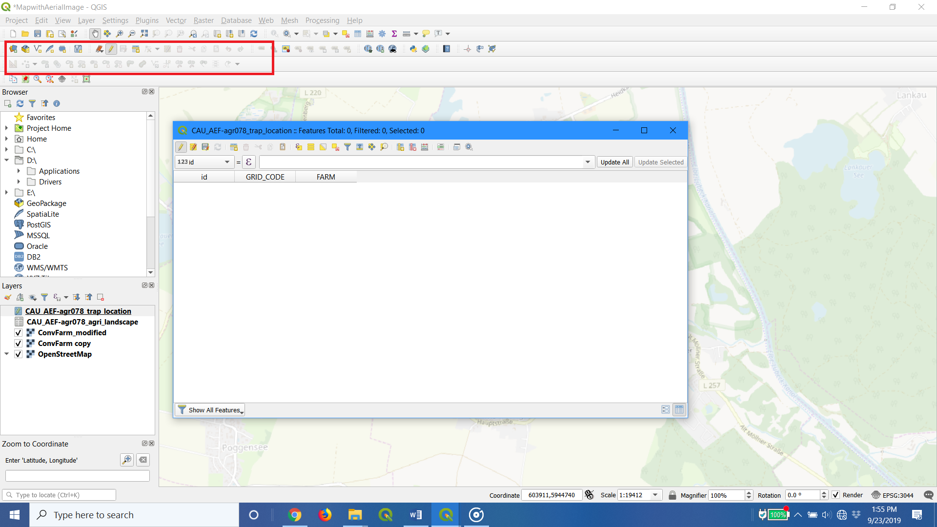
I am new to QGIS. I have one picture with the attribute table I created and the greyed out toolbar. Yes, I have it in "Toggle editing" but doesn't seem to make a difference....even after I close out of the attribute table. Am I missing something?

The shapefile (trap_location) is for points, and agri_landscape is for polygons.

enter image description here

6
  • Your table does not have geometries. Is it a CSV?
    – MrXsquared
    Commented Sep 23, 2019 at 20:03
  • @MrXsquared The guide I have only specifies to build the Grid_code and farm columns, setting them as integer and text, respectively. The table is set as a starting point before starting polygons. If I add rows of information I still cannot edit....
    – RBrock
    Commented Sep 23, 2019 at 20:12
  • Yes, because it isnt a geometry table. You can only edit or add geometries to a geometry-table. Do you want to create new geometry informations or edit existing ones?
    – MrXsquared
    Commented Sep 23, 2019 at 20:15
  • @MrXsquared Create new.
    – RBrock
    Commented Sep 23, 2019 at 20:17
  • You can click on "New Shapefile layer" or "New Geopackage layer" for example. Make sure to set the correct geometry-type and add the columns you want it to have.
    – MrXsquared
    Commented Sep 23, 2019 at 20:21

4 Answers 4

3

You can not use advanced digitizing bar here because your layer isnt a geometry layer. To create a new layer with geometries you can click on "New Shapefile layer" or "New Geopackage layer" for example. Make sure to set the correct geometry-type and add the columns you want it to have.

0

I had the same problem with a coordinate system set to Geographic (EPSG:4326). When I changed it back to a projected coordinate system the Advanced Digitizing tab re-activated.

0

I stumbled onto another method Vector => Geoprocessing tools then Dissolve.

Seems to do the trick, as an export renders as a single line.

0

Advanced digitizing panel is showing up distance(d) or angle (a) only when the default measurement is in feet. It is grayed when the distance measurement is in meters.

its available in project properties/ general. for the individual project or in settings/ options/ map tools for entire installation.

It worked for me even though not my choice of measurement coming from a metric background.

Your Answer

By clicking “Post Your Answer”, you agree to our terms of service and acknowledge you have read our privacy policy.

Not the answer you're looking for? Browse other questions tagged or ask your own question.