0

I am trying to add a FEMA Hazard WMS layer to QGIS. I am using QGIS version 3.4.11-Madeira. I have used a shapefile in the past, but the hope with the WMS is that it would auto-update.

I went to https://hazards.fema.gov/femaportal/wps/portal/NFHLWMS and copied the url https://hazards.fema.gov/gis/nfhl/rest/services/public/NFHLWMS/MapServer/WMSServer?request=GetCapabilities&service=WMS

Then I clicked add new layer, WMS, new, I pasted the URL WMS url above and clicked connect. I get the following response.

The server you are trying to connect to does not seem to be a WMS server. Please check the URL.

Instead of the capabilities string that was expected, the following response has been received:Could not get WMS capabilities: error occurred while parsing reference at line 86 column 118

This is probably due to an incorrect WMS Server URL.

I cannot figure out what I am doing wrong.

2
  • I am using QGIS version 3.4.11-Madeira
    – Hanover
    Commented Dec 2, 2019 at 17:07
  • 1
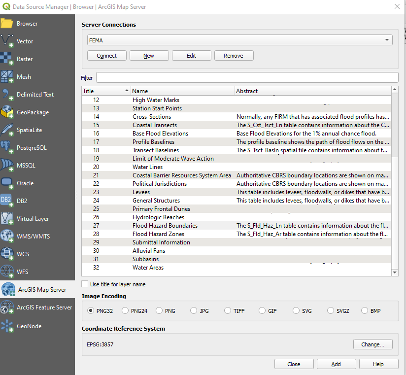
    works when you use ArcGISMapServer connection rather than WMS/WMTS connection
    – Mapperz
    Commented Dec 2, 2019 at 17:20

1 Answer 1

1

I got the same error messages when trying to connect to the WMS server, but I was able to connect to the data by two other methods:

  1. Use the links provided under the header, "ArcGIS REST Service," to add an ArcGIS Map Server connection.

    enter image description here

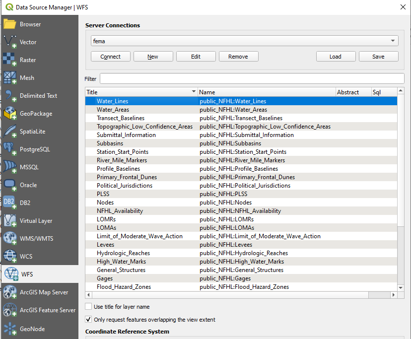
  2. Use the link for OGC Web Feature Service (WFS) to connect to a WFS server.

    enter image description here

1
  • I used the ArcGIS REST Service and it worked! Thanks for the help.
    – Hanover
    Commented Dec 2, 2019 at 17:48

Your Answer

By clicking “Post Your Answer”, you agree to our terms of service and acknowledge you have read our privacy policy.

Not the answer you're looking for? Browse other questions tagged or ask your own question.