2

I use 2 rasters orthophotos .TIFF : 1) the low resolution covering a large area. 2) the high resolution covering a small area and using an alpha band around the point of interest.

My aim is to merge this 2 files to deliver only one file that used the best of each image (full area in low resolution , and point of interest in high resolution ). That's why I've tried:

  • Raster -> Miscellaneous -> Building Visual Raster : it merged both orthophoto using the right resolution for both parts, but the Alpha channel of the High resolution orthophoto (around the point of interest area) overwrites the other orthophoto: this solution doesn't work.

Do you have any idea how could I reach my aim? I use QGIS 3.10 but can use 3.4 or any other version.

Solution ==>

1) Warp lowest resolution image in order to reach the same resolution for both rasters.

2) Raster -> Miscellaneous -> Merge : it merged both orthophotos, at the good resolution, but the color of the part overlapped with data is not the same as the original image (high rez one).

3) Extend the histogram

1 Answer 1

2

This is not something I have tried before, but my instinct is to "warp" the low resolution raster to the same pixel size as the high resolution image.

This way the higher resolution image will be able to "merge" into the extra pixels created for the low resolution image.

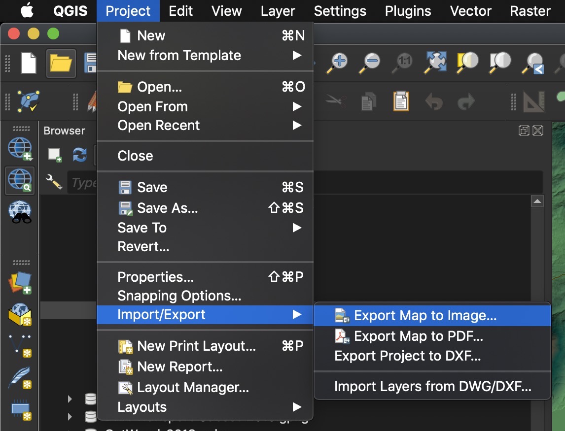
--> You can also try Project > Import/Export > Export Map to Image...

Project > Import/Export > Export Map to Image...

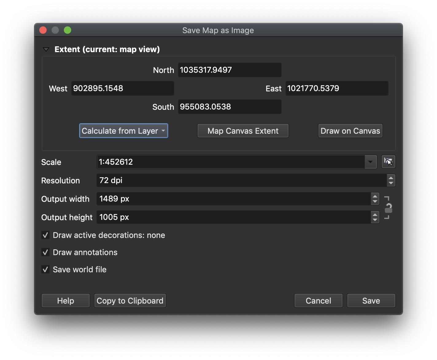
You can use the extent of your largest Orthophoto, and try adjusting the DPI to get the resolution you desire.

enter image description here

6
  • Hi, Firstly thanks so much for answering. How can I wrap 2x ORthophotos together... I've heard about wrapping DEM + Orthophoto, but I've no idea how can I increase the pixel total. Can I do something like that into QGIS? When builder Virtual Raster, it asked an option to use the "Higher precision" of rasters. But, when using "MERGE" process, it is not an option anymore =/
    – zlikotp
    Commented Dec 15, 2019 at 7:55
  • I've tried "warp" and then merged 2x rasters keeping the highest resolution. It works! thanks But I've realize that there even if pixel color seems the good one, the brightness is too light into the part overlapped. Is there a way to keep the light of the image?
    – zlikotp
    Commented Dec 15, 2019 at 15:18
  • Ok. Depending on your needs you can try Project > Import/Export > Export Map to Image...
    – Mars
    Commented Dec 15, 2019 at 15:58
  • It seems I'm not able to reproduce the same resolution with ImporT/export>Export Map to image. I think I could reach my aim by avoiding alpha band (white color) and using the Virtual Raster building solution... but I've no idea how to avoid alpha band.
    – zlikotp
    Commented Dec 15, 2019 at 17:32
  • I were able to solve the lightness issue by "Extending the histogram" :)
    – zlikotp
    Commented Dec 15, 2019 at 19:33

Your Answer

By clicking “Post Your Answer”, you agree to our terms of service and acknowledge you have read our privacy policy.

Not the answer you're looking for? Browse other questions tagged or ask your own question.