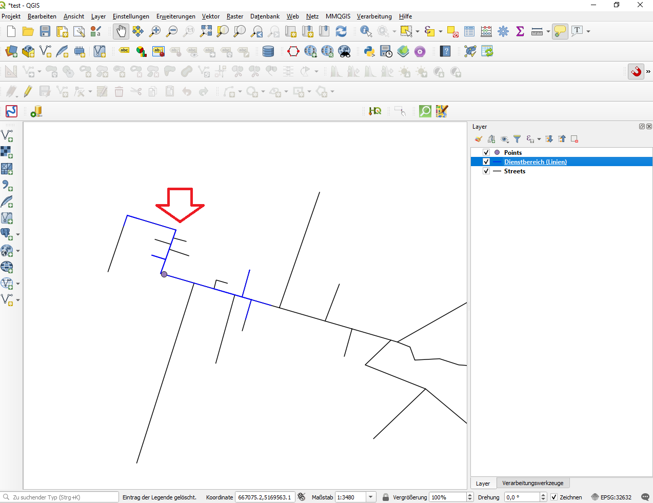
using the Service Area Tool from the Network Analysis (Toolbox) gives strange results. As you can see on the screenshot the calculated blue service area (network: streets; start points: points; path type: shortest; no advanced parameters set) does contain some of the side roads some others not although they should be clearly inside the service area. How is this possibile?
I already checked the streets layer (no gaps) and tried to run it with a multiline- and singleline-Layer (same result). Layers are in the same projected coordinate system. I'm using QGIS 3.6.3-Noosa.
Would be very happy if someone had an idea how to handle this. Thanks in advance!

