1

I have a NetCDF file containing surface sea temperatures that I want to convert into a ESRI shapefile.

I have tried following this link: https://freegistutorial.com/how-to-export-layer-to-shapefile-on-qgis/ but I cannot see the ESRI Shapefile format in the drop down list.

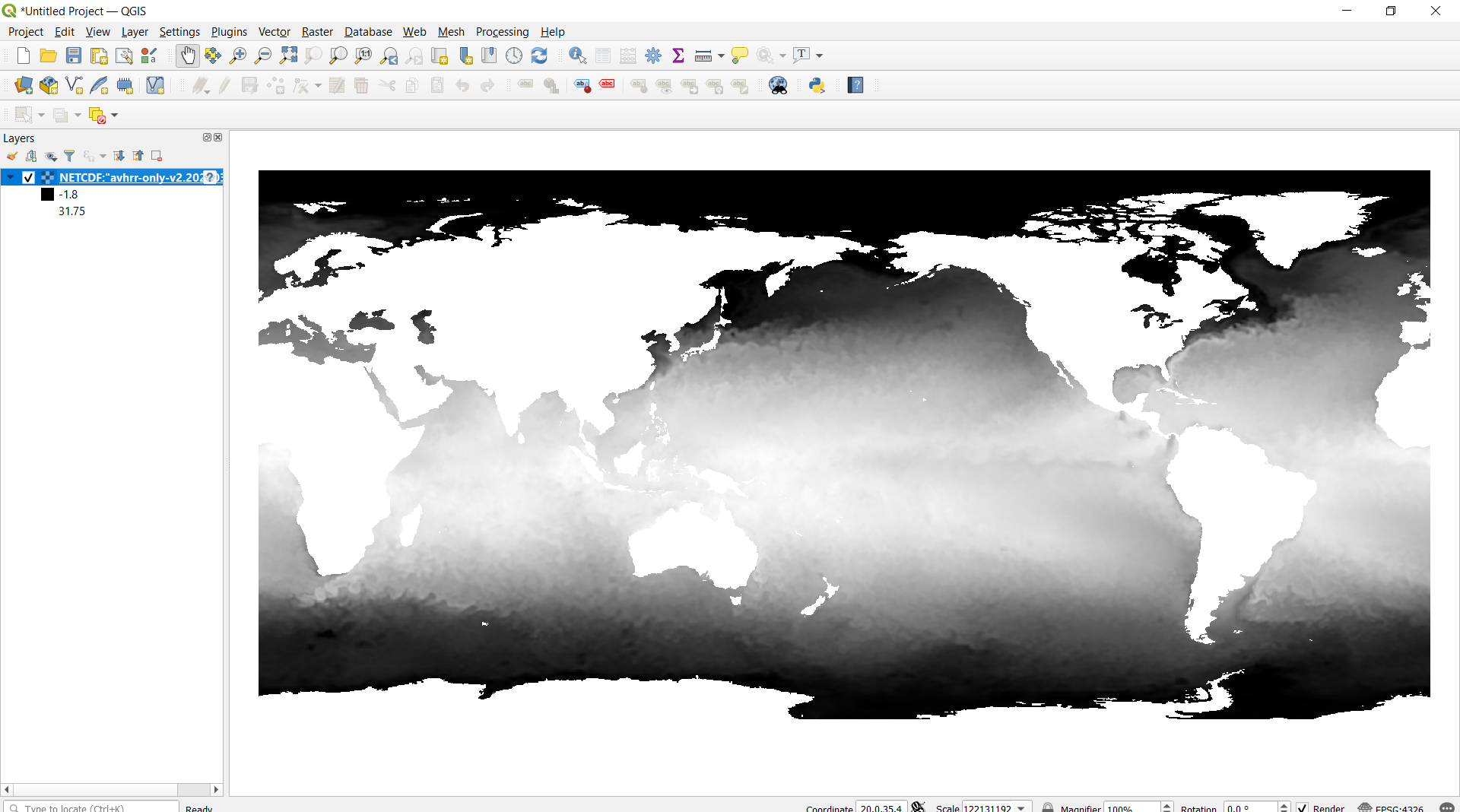
netCDF loaded into layer

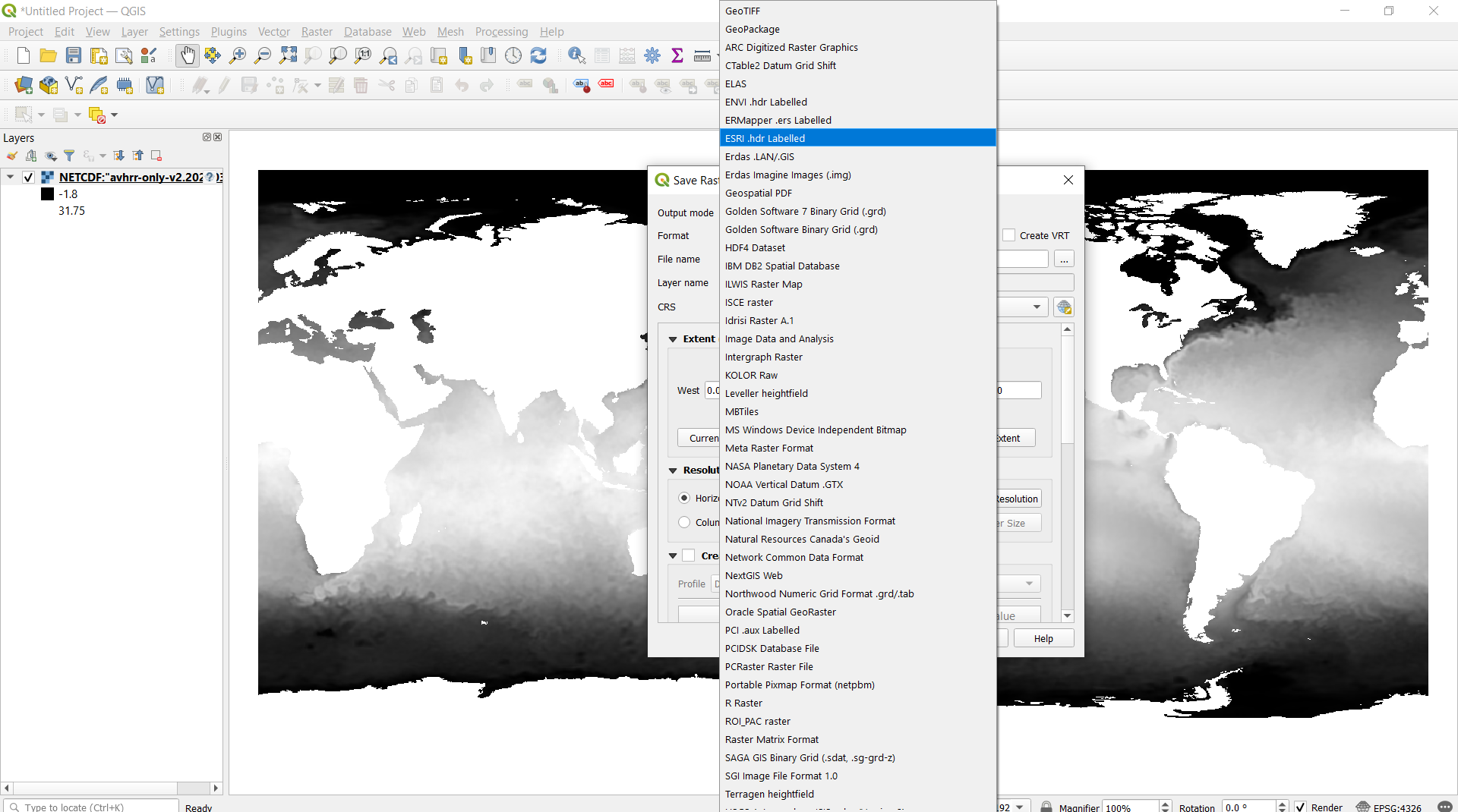
I loaded the CDF file -> right click -> Export -> save as, and I come to this screen where I can choose the format type.

no Shape file option

There is no shapefile option and I am unsure what I'm doing wrong here.

1
  • 3
    Shapefile is a vector format. While you can vectorize a raster, it makes no sense to Save As from a raster format.
    – Vince
    Commented Aug 15, 2020 at 15:58

1 Answer 1

3

When you "drag and drop" your nc file onto the QGIS desktop, QGIS will read it as a raster layer as you see it.

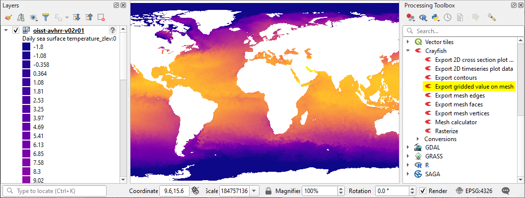
(1) Read the NetCDF file as a mesh file.

Go to the menu: Layer > Add Layer > Add Mesh Layer... and select the nc file.

enter image description here

(2) Use Crayfish plugin to export the data

Install the Crayfish plugin and you will find various tools in the Processing Toolobox. Start Export gridded value on mesh tool (see the image above).

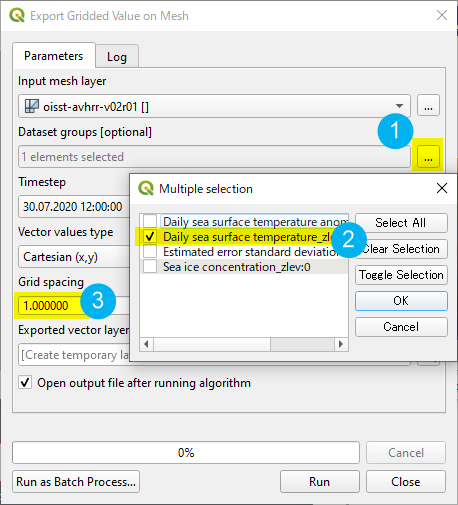
In the Export gridded value on mesh tool window:

  1. Click on a small ellipsis [...] button of the Dataset groups.
  2. Select the data you wish to export (e.g. sea surface temperature as this example)
  3. Set the Grid Spacing according to the required level of details.
  4. Click on [Run] button.

enter image description here

(3) The data will include many nan values (such as continental area). You may want to use Extract by attribute tool (or any other tools) to remove nan.

enter image description here

Your Answer

By clicking “Post Your Answer”, you agree to our terms of service and acknowledge you have read our privacy policy.

Not the answer you're looking for? Browse other questions tagged or ask your own question.