9

I have a set of coordinates (X, Y) and I do not know which coordinate system they are actually in.

They are definitely in a projected coordinate system since they are not in decimal degrees. However, I need to determine the CRS and accordingly transform it because they do not overlay other layers.

Below are the sample of coordinates. Perhaps they are in Gauss Krüger CRS. How can I transform it to EPSG:25832?

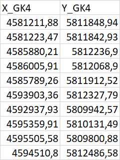
enter image description here

3 Answers 3

12

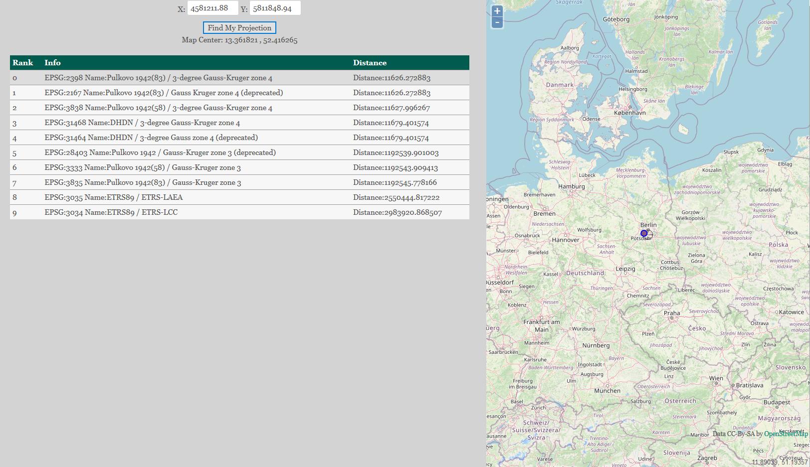
Also you can try using projfinder. For instance, when one paste provided coordinates (4581211.88, 5811848.94)

projfinder

You will see several options. Then you may assume the CRS, which is mostlikely the "EPSG:31468 | DHDN / 3-degree Gauss-Kruger zone 4".

But in your case I will simply follow what @Erik explained.

And then answering your another question "How can I transform it to EPSG:25832?" It depends on which software/libraries you have access to. It seems to be a new separate question for GIS SE. Maybe you can try MyGeodata Converter.


References:

8

You can't determine the projection of a set of points just from the coordinates. Without some other information they are just random numbers. Go back to the data supplier and make them give you some metadata.

If you know where the points are supposed to be then it may be possible to guess which projection they are in.

1
  • That is technically correct, although you can do an educated guess based on the GK4 column header and the leading 4 in the x-coordinate.
    – Hans Erren
    Commented Nov 24, 2020 at 11:48
8

It says right there in your column title "GK4" - which is for Gauss-Krüger Zone 4 (https://epsg.io/31468).

Another hint is the leading 4 on the X-coordinates.

An last but not least you should know where the data should be situated and thus reduce the CRS-options.

5
  • Thank you for your answer. it was useful. However, i also want to transform the point geometry to EPSG: 25832. Could this be done simply by using ST_Transform function, `ST_transform(geom, 25832)´ Would this work? I have other layers in CRS 25832. So for further analysis I need to get this point layer also in the same CRS
    – Jio
    Commented Nov 24, 2020 at 9:30
  • Simply save it to a new shapefile using EPSG 25832 @Jio. If you need the X and Y coordinates, you need to use the field calculator using $x and $y after saving to the new CRS.
    – Erik
    Commented Nov 24, 2020 at 9:34
  • I do not use ArcGIS. There are too many data points. GIS software won't be able to load them or will take very long. Therefore I am using PostGIS. How can I correctly transform the geometry with PostGIS function?
    – Jio
    Commented Nov 24, 2020 at 9:49
  • 5
    Not like QGIS uses shapefiles, too. Please define "too many data points", and refrain from asking different follow-up questions in the comments.
    – Erik
    Commented Nov 24, 2020 at 9:52
  • there are over 40 million data points. And I asked because QGIS is crashing when i try to export to shapefile.
    – Jio
    Commented Nov 24, 2020 at 12:53

Your Answer

By clicking “Post Your Answer”, you agree to our terms of service and acknowledge you have read our privacy policy.

Not the answer you're looking for? Browse other questions tagged or ask your own question.